Page summary
EuroGeographics
EuroGeographics is the not-for-profit association representing the European National Mapping, Cadastral and Land Registry Authorities. The Association’s greatest strength lies in bringing together authoritative data and collective expertise across national boundaries – a powerful signal of certainty and trust in an uncertain world.
We are proud to represent around 90% of the official bodies responsible for geodetic surveying, topographic mapping, cadastral surveys and land registration in geographical Europe. We deliver benefits for each member, regardless of the geographical, technical, political, organisational, linguistic and business context in which they work.
EuroGeographics supports the public good by representing our members’ interests, maintaining networks that help our members improve their capabilities and role, and by facilitating access to and use of our members’ geospatial data and services. By providing a single point of contact, we enable government, business and citizens to benefit from their collective expertise, data and services.
We offer three categories of membership: Full Member, Associate Member and Observer Member.
Official Geospatial Data
Geospatial data – fundamental information about location – is one of Europe’s most valuable resources in achieving a strong and secure, prosperous and competitive Union. Geospatial data not only pinpoints and verifies where things happen, it also enables us to make connections between people and places. By providing context and clarity to raw information, geospatial data empowers us to take decisive action and target it where it will make the greatest impact.
Geospatial data delivered by EuroGeographics’ members, the European National Mapping, Cadastral and Land Registration Authorities, is defined as high-value and has its origin and sovereignty in Europe. It is a trusted and important enabler of cross-border applications, offers a wealth of opportunities for reuse due to its compatibility with other datasets, and is an essential component of national, European and global critical infrastructure.
However, while legislation such as the INSPIRE Directive and the High-Value Data Implementing Regulation ensures that authoritative geospatial data is accessible through national geoportals, accessibility alone does not make data usable across borders.
EuroGeographics and its members have met this challenge head-on – translating EU high-value data rules into a practical, seamless cross-border information solution.
The journey began with Open Maps For Europe (OME), co-financed by the Connecting Europe Facility of the EU, and OME2, co-funded by the EU. Together they proved that national expertise could unlock pan-European geospatial data. Now a self-funded consortium – EuroGeographics, BKG (Germany), IGN France, and Kadaster Netherlands – is taking this further with EuroCoreReferenceMap.
Running until the end of 2028, EuroCoreReferenceMap builds on OME2’s technical and organisational foundations to deliver a pan-European dataset designed specifically to meet EU needs. By establishing a robust geospatial framework, it lays the foundation for a future European Geospatial Data Infrastructure, marking a new era for authoritative geospatial data in Europe.
European Geospatial Data Infrastructure
EuroGeographics is committed to empowering European society through the use of reliable pan-European geospatial information. We believe that, as a cornerstone of European digital infrastructure and economic competitiveness, our members’ trusted sovereign geospatial data deserves recognition and sustained investment at the European level.
Official geospatial data delivers three interconnected strategic capabilities:
- Anchoring space-based Earth observation, digital services and statistical analysis to the physical world.
- Connecting different datasets to provide context and insights for decisive action.
- Enabling cross-border applications, unlocking economic value through interoperability and reuse.
The strategic case for a European Geospatial Data Infrastructure
Delivering this capability requires strategic investment of less than 1% of the €175+ MFF budget earmarked for data infrastructure to:
- Guarantee long-term availability of foundational geospatial data for Earth observation, digital services, and statistics.
- Secure sustainable funding for sovereign data to ensure a self-sufficient, resilient, competitive Europe.
- Establish an EU policy home to ensure Europe’s digital backbone is built on European data.
Securing Europe’s geospatial data infrastructure requires a remarkably modest investment relative to the value of securing Europe’s digital sovereignty, economic resilience, and competitive advantage.
Case studies
EuroGeographics members’ fulfil an essential role ensuring fundamental information about location is available for confident, informed decision making. Our library of case studies has many examples, from security, climate change and environmental monitoring to economic growth and prosperity.
The value of official geospatial data
Latest Case Studies
History
EuroGeographics has been proudly representing Europe’s National Mapping, Cadastral and Land Registration Authorities for 25 years. The Association builds on the legacy of the Comité Européen des Responsables de la Cartographie Officielle (CERCO) and the Multi-purpose European Ground Related Information Network (MEGRIN), which merged in 2000.
2003
 Map projections for Europe agreed with EUREF and adopted by the European Commission.
2009
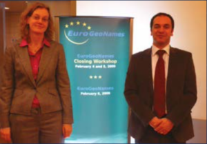 The EuroGeoNames project (2006-2009) is completed as a prototype implementation for an INSPIRE service. This work has been significantly improved designing the GeoLocator service during the European Location Framework project (2013-2016) and continues in the development and publication of a Regional Gazetteer under the umbrella of the Open European Location Services (Open ELS ) Project (2017-2019). The background information has been compiled in the conference paper submitted to the 11th UN Conference on the Standardization of Geographical Names.