OME2 successfully delivers harmonised cross-border data as 18,000 users download 15,500 datasets

More than 18,000 users have downloaded some 15,500 pan-European datasets and carried out 96.4 million web service transactions since Open Maps For Europe 2 (OME2) launched in early 2023.

The three-year project saw users of the Open Maps For Europe platform increase by 450% – from 4,000 to just over 22,000. In particular, the OME2 high-value large-scale prototype exceeded expectations, attracting 600 registered users – more than quadruple the initial target of 150.  

Since its release in 2024, the 1:10,000 scale authoritative dataset, covering administrative boundaries, transport and hydrography across 10 countries, has generated nearly 5,000 WFS transactions. It is the first dataset created using the new production process, developed by OME2 Consortium member, National Institute of Geographic and Forest Information (IGN France), to deliver edge-matched official geospatial information from multiple national sources.

In addition to IGN France, the project partners comprise: EuroGeographics, the not-for-profit association for Europe’s National Mapping, Cadastral and Land Registration Authorities; National Geographic Institute, Belgium; Hellenic Cadastre; General Directorate for the Cadastre, Spain; and Cadastre, Land Registry and Mapping Agency, The Netherlands.

Angela Baker, Head of Operations and Data, EuroGeographics said: ““The consortium is delighted to report that the project has achieved all its objectives and significantly increased the number of users of pan-European data.”

“OME2 creates the foundation for a pan-European Spatial Data Infrastructure by solving the complex challenge of delivering usable sovereign data across Europe. This fulfils a long-standing EU requirement for streamlined access to an authoritative cross-border dataset without navigating multiple national portals or complex data integration.”

“The production process and technical specifications save users time, effort, and resources by providing harmonised data from multiple countries through a single portal with one easy-to-understand licence. This advances the data-sharing tools needed for free-flowing, interoperable data across the single market. It also supports the European Strategy for Data, as well as the Open Data and Public Sector Information Directive by enabling EuroGeographics members to apply OME2 techniques nationally and share best practices."

OME2 has delivered:

High-value large-scale pan European prototype

  • 1: 10 000 scale authoritative administrative boundary, transport and hydrographic data for Austria, Belgium, Czech Republic, Denmark, Finland, France, Luxembourg, Spain, Switzerland and The Netherlands.
  • Data in Geopackage download by theme, country or administrative area or WFS, WMS or WMTS via the Open Maps For Europe portal.

New production process and technical specification

  • Underpinned by national expertise in integration of core geospatial data.
  • Quality, edge-matching, harmonisation and generalisation tools

Enhanced existing datasets available via the Open Maps For Europe portal including:

Open Cadastral Map: the prototype map service for European cadastral data

  • Includes all 15 planned countries with Basemap introduced to aid user experience.
  • Delivery of a pan-European Cadastral Data Strategy.

OME2 ran from 2023 to the end of 2025. It was co-funded by the European Union with matched investment from EuroGeographics and its members.

EuroGeographics is an international not-for-profit organisation (AISBL/ IVZW under Belgian Law. BCE registration: 833 607 112) and the membership association for the European National Mapping, Cadastral and Land Registry Authorities.

The OME2 project was co-funded by the European Union. It was delivered by a consortium comprising: EuroGeographics, the not-for-profit membership association for Europe’s National Mapping, Cadastral and Land Registration Authorities; National Geographic Institute, Belgium; National Institute of Geographic and Forest Information, France; Hellenic Cadastre; General Directorate for the Cadastre, Spain; and Cadastre, Land Registry and Mapping Agency, The Netherlands.

Views and opinions expressed are those of the author only and do not necessarily reflect those of the European Union or European Commission. Neither the European Union nor the European Commission can be held responsible for them.

OME2 adds five new countries and hydrography theme to final release of high-value data prototype

Open Maps For Europe 2 (OME2) has released the final version of its high-value large-scale pan European prototype which now covers 10 countries.

The milestone means that 1: 10 000 scale authoritative administrative boundary, transport and hydrographic data is available for Austria, Belgium, Czech Republic, Denmark, Finland, France, Luxembourg, Spain, Switzerland and The Netherlands. Created using a unique production process that harmonises and edge-matches official geospatial data from national mapping, land registration and cadastral agencies (NMCAs) into a single dataset, the prototype is available via the Open Maps For Europe portal.

OME2 is being delivered by a consortium comprising: EuroGeographics, the not-for-profit association representing the European NMCAs; National Geographic Institute, Belgium; National Institute of Geographic and Forest Information, France (IGN France); Hellenic Cadastre; General Directorate for the Cadastre, Spain; and Cadastre, Land Registry and Mapping Agency (Kadaster), The Netherlands.

Angela Baker, Head of Partnerships and Sustainability, EuroGeographics said: “The production process, developed by OME2 consortium member, IGN France, demonstrates how NMCAs can fulfil a long-standing EU requirement for streamlined access to authoritative cross-border information without navigating multiple national portals or complex data integration.”

“Furthermore, the prototype delivers data for three key themes identified as essential by users and defined as high value by the European Commission – administrative boundaries, transport and hydrography – thereby laying the foundation for a broader pan-European Spatial Data Infrastructure aligned with key EU Policy objectives and UN core geospatial data recommendations.”

OME2, which has also enhanced the five existing datasets available via Open Maps For Europe, concludes at the end of 2025 and is co-funded by the European Union with matched investment from EuroGeographics and its members.

EuroGeographics is an international not-for-profit organisation (AISBL/ IVZW under Belgian Law. BCE registration: 833 607 112) and the membership association for the European National Mapping, Cadastral and Land Registry Authorities.

The OME2 project is co-funded by the European Union. It is being delivered by a consortium comprising: EuroGeographics, the not-for-profit membership association for Europe’s National Mapping, Cadastral and Land Registration Authorities; National Geographic Institute, Belgium; National Institute of Geographic and Forest Information, France; Hellenic Cadastre; General Directorate for the Cadastre, Spain; and Cadastre, Land Registry and Mapping Agency, The Netherlands.

Views and opinions expressed are however those of the author only and do not necessarily reflect those of the European Union or European Commission. Neither the European Union nor the European Commission can be held responsible for them.

Marking a year of celebration and ambition – 2025 Highlights

For 25 years, EuroGeographics has proudly represented Europe's National Mapping, Cadastral and Land Registration Authorities. Our silver jubilee has been one of both celebration and ambition as we reflect on past accomplishments while committing to deliver the next generation of pan-European high-value datasets. 

The highlights of 2025 again demonstrate the benefits of bringing together members’ data and expertise across national boundaries which remains our primary strength. None of this would be possible without the continued support of our members who are committed to enabling a geospatial framework for a strong and secure Europe.

EuroGeographics at EAASI annual partnership summit  

EuroGeographics President, Tomaž Petek represented members at the European Association of Aerial Surveying Industries (EAASI) recent annual Partnership Summit in Croatia. 
 
Mr Petek, who is Director General of Surveying and Mapping Authority of the Republic of Slovenia, was delighted to give one of the introductory speeches alongside Marijan Marjanović from the State Geodetic Administration of the Republic of Croatia
 
EAASI is the European association of the aerospace imaging industry, founded in 2019 as a non-profit organization based in Belgium. The association connects companies engaged in aerial surveying, promotes the use of high-quality geospatial data and international standards, and strengthens cooperation between members and public institutions. Its aim is to develop a sustainable European market for geospatial information generated by aerial photography.
 
During the four days of the meeting in Dubrovnik, EAASI hosted an interesting program of workshops, introductory lectures and events, all exclusively dedicated to the aerospace imaging industry and establishing partnerships in securing the geodetic future.


OME2 unlocks pan-European high-value data and calls for EU commitment to long-term funding

Open Maps For Europe 2 (OME2) has unlocked one of Europe's most valuable assets by turning EU rules for high-value data into a seamless cross-border solution for governments, businesses, and citizens.
 
The OME2 pan-European prototype harmonises and edge-matches official geospatial data from national mapping, land registration and cadastral agencies into a single dataset. This fulfils a long-standing EU requirement for streamlined access to authoritative cross-border information without navigating multiple national portals or complex data integration.  
 
The final version – unveiled at a showcase for policymakers in Brussels – provides 1: 10 000 scale authoritative administrative boundary, transport and hydrographic data for Austria, Belgium, Czech Republic, Denmark, Finland, France, Luxembourg, Spain, Switzerland and The Netherlands.
 
OME2 is being delivered by a consortium comprising: EuroGeographics, the not-for-profit association representing the European National Mapping, Cadastral and Land Registration Authorities; National Geographic Institute, Belgium; National Institute of Geographic and Forest Information, France (IGN France); Hellenic Cadastre; General Directorate for the Cadastre, Spain; and Cadastre, Land Registry and Mapping Agency (Kadaster), The Netherlands.
 

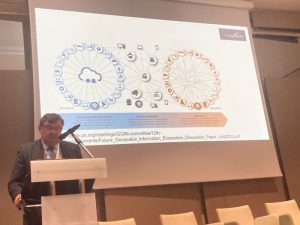
Sallie Payne Snell, Secretary General and Executive Director, EuroGeographics addresses EU polcymakers at OME2 showcase.

Sallie Payne Snell, Secretary General and Executive Director, EuroGeographics said: “The consortium is delighted that OME2, which has also enhanced the five existing datasets available via the Open Maps For Europe portal, has seen higher-than-expected user numbers. In fact, we have more than doubled our initial aim of attracting 150 unique users of the OME2 high-value large-scale prototype, with 600 registering for the dataset and almost 5,000 WFS transactions since its launch in 2024.”
 
“This proves that EuroGeographics and its members can deliver large-scale edge-matched data that users want – laying the foundation for a broader pan-European Spatial Data Infrastructure.”
 
She added: "OME2 concludes at the end of 2025 and is co-funded by the European Union with matched investment from EuroGeographics and its members. However, securing long-term funding for Europe-wide sovereign high-value data remains a challenge.”
 
"A self-funded consortium, bringing together EuroGeographics and its members from Germany's Federal Agency for Cartography and Geodesy (BKG), IGN France, and Kadaster Netherlands, has stepped forward to take the outcomes of OME2 to the next level. Together, we are committed to providing the expertise and initial investment for this exciting new project, which will be publicly launched in early 2026 and run until 2028.”
 
"If Europe is to continue benefiting from comprehensive cross-border sovereign high-value data after this date, the European Commission must commit to sustainable funding, ongoing infrastructure investment, and a policy home for geospatial data. Trusted pan-European geospatial data is recognised as one of Europe's most valuable resources – it deserves recognition and sustained investment at the European level."
 
EuroGeographics is an international not-for-profit organisation (AISBL/ IVZW under Belgian Law. BCE registration: 833 607 112) and the membership association for the European National Mapping, Cadastral and Land Registry Authorities.
 
OME2 is developing a new production process and technical specification for free-to-use, edge-matched data under a single open licence. Authoritative 1:10 000 scale data for 10 countries will be delivered via the user interface built by the award-winning Open Maps For Europe Project. OME2 is also enhancing the five existing Open Maps For Europe datasets, including the pilot Open Cadastral Map.
 
The OME2 project is co-funded by the European Union. It is being delivered by a consortium comprising: EuroGeographics, the not-for-profit membership association for Europe’s National Mapping, Cadastral and Land Registration Authorities; National Geographic Institute, Belgium; National Institute of Geographic and Forest Information, France; Hellenic Cadastre; General Directorate for the Cadastre, Spain; and Cadastre, Land Registry and Mapping Agency, The Netherlands.

Views and opinions expressed are however those of the author only and do not necessarily reflect those of the European Union or European Commission. Neither the European Union nor the European Commission can be held responsible for them.

Collaboration increases number of official national geospatial datasets available via CORDA

More than 100 new datasets, including seven targeting the update of the EU-Hydro product, are now available to Copernicus Services thanks to a collaboration that streamlines access to official geospatial information.

The Copernicus Framework Agreement between EuroGeographics and its members is a practical solution for overcoming legal barriers to accessing authoritative data for the Copernicus In-Situ component. It has significantly increased the number of national datasets available via CORDA, a centralised gateway for authorised users to access geospatial reference data from European countries participating in the Copernicus component of the EU Space programme.

Currently, 33 National Mapping, Cadastral and Land Registration Authorities are either making their open data easily accessible or have signed the agreement which covers the Copernicus Emergency Mapping Service (CEMS); the Copernicus Land Monitoring Service (CLMS); and the Copernicus Security Service (CSS). As a result, in addition to the 117 newly available datasets, users of CORDA also have access to 42 updated datasets.

Angela Baker, Head of Partnerships and Sustainability, EuroGeographics: “We are proud to represent our members, Europe’s National Mapping, Cadastral and Land Registration Authorities, and committed to enabling easy access to both their data and their technical expertise.”

“This licence agreement ensures members’ data, which is an essential component of national, European and global critical infrastructure, is available for disaster response and recovery, security and land monitoring and increases its use through the Copernicus In-Situ Component. In addition, we have established a network of national technical contacts who are instrumental in trouble-shooting issues, improving coordination and ensuring the smooth delivery of data to CORDA.”

“Our approach respects the autonomy of our members whilst also laying the foundations for a future-proof framework for continued collaboration with the EEA to support Copernicus objectives and avoid duplication of effort to save costs and focus investment.”

Jose Miguel Rubio Iglesias, Copernicus In-Situ Data Expert, EEA added: “Copernicus relies on the availability of a wide variety of in-situ data, including high-quality, authoritative geospatial data which is essential for ensuring the accuracy and reliability of Copernicus data, products and services. By facilitating access to geospatial information from official providers, our agreement with EuroGeographics strengthens synergies with its members to help us meet growing user demands for real-time, high-resolution geospatial information. This in turn ensures fit-for-purpose products that also bring valuable benefits back to the Member States.”

“We continue to build on this collaboration to address the evolving needs of the Copernicus component of the EU Space Programme and we ensure that National Mapping, Cadastral and Land Registration Authorities continue to be recognised for their essential contributions to Copernicus.”

EuroGeographics is an international not-for-profit organisation (AISBL/ IVZW under Belgian Law. BCE registration: 833 607 112) and the membership association for the European National Mapping, Cadastral and Land Registry Authorities.

EuroGeographics Messenger Newsletter 02/2025

Catch up with all the latest news from EuroGeographics as well as the Open Maps For Europe 2 (OME2) Project in our latest newsletter.

Read all about it: Messenger 02/2025

OME2 Project publishes three new case studies

The Open Maps For Europe 2 (OME2) project has published three new case studies demonstrating how the  harmonised high-value large-scale data prototype and enhanced Open Maps For Europe datasets are delivering value to users in the public and private sectors as well as academia.

Two case studies show how data delivered by OME2 is being used by Eurostat, which provides official statistics to the European Union, to supporting cross-border analyses of healthcare and education services, and enable spatial analysis to understand housing demand and supply. The third case studies shows how the University of Siena uses EuroRegionalMap, multi-themed topographic open data, as a base map for the geological cartography the new Digital Structural Model of Italy (DiSMI).

Read the OME2 Case Studies here.

The OME2 project, co-funded by the European Union, is being delivered by a consortium comprising: EuroGeographics; National Geographic Institute, Belgium; National Institute of Geographic and Forest Information, France; Hellenic Cadastre; General Directorate for the Cadastre, Spain; and Cadastre, Land Registry and Mapping Agency, The Netherlands.

The project corresponds with Member States’ obligations to implement high-value data and will be completed at the end of 2025.


OME2 adds five new countries to final release of Open Cadastral Map

Five new countries have been added to the final release of the Open Cadastral Map which has been enhanced by the Open Maps For Europe 2 (OME2) project.

The addition of Belgium, Estonia, Ireland, Croatia, and Switzerland means the prototype map service now includes data from 15 of Europe’s National Mapping, Cadastral and Land Registration Authorities.

The OME2 project runs until the end of 2025 and is being delivered by a consortium comprising: EuroGeographics, the not-for-profit membership association for Europe’s National Mapping, Cadastral and Land Registration Authorities; National Geographic Institute, Belgium; National Institute of Geographic and Forest Information, France; Hellenic Cadastre; General Directorate for the Cadastre, Spain; and Cadastre, Land Registry and Mapping Agency, The Netherlands.

Angela Baker, Head of Partnerships and Sustainability, EuroGeographics said: “Open Cadastral Map compiles and harmonises INSPIRE open data to provide an overview of what is available and where to find it via user-friendly links for direct download from national geoportals. The vision is that this will provide the foundation for a single access point for easily finding and using authoritative cadastral information in the future.”

“Thanks to the OME2 Project, which is co-funded by the European Union, not only have we been able to expand the Open Cadastral Map, but, together with our members, we are also developing the pan-European Cadastral Data Strategy. This will be delivered by the end of 2025 and defines stakeholders as well as the technology, processes, resources and best practices required to support the long-term delivery of official high-value data for addresses, cadastral parcels, buildings and administrative units.”

The Open Cadastral Map is available through the Open Maps For Europe interface and signposts users to data from Belgium, Croatia, Czech Republic, Denmark, Estonia, Greece, Ireland, Latvia, Luxembourg, Poland, Slovakia, Slovenia, Spain, Switzerland, and The Netherlands

EuroGeographics is an international not-for-profit organisation (AISBL/ IVZW under Belgian Law. BCE registration: 833 607 112) and the membership association for the European National Mapping, Cadastral and Land Registry Authorities.

The OME2 project is co-funded by the European Union. It is being delivered by a consortium comprising: EuroGeographics, the not-for-profit membership association for Europe’s National Mapping, Cadastral and Land Registration Authorities; National Geographic Institute, Belgium; National Institute of Geographic and Forest Information, France; Hellenic Cadastre; General Directorate for the Cadastre, Spain; and Cadastre, Land Registry and Mapping Agency, The Netherlands.  OME2 is developing a new production process and technical specification for free-to-use, edge-matched data under a single open licence. Authoritative 1:10 000 scale data for 10 countries will be delivered via the user interface built by the award-winning Open Maps For Europe Project. OME2 is also enhancing the five existing Open Maps For Europe datasets, including the Open Cadastral Map.

Views and opinions expressed are however those of the author only and do not necessarily reflect those of the European Union or European Commission. Neither the European Union nor the European Commission can be held responsible for them.