European Policy experts share insights for UN paper on authoritative geospatial data for disaster risk reduction and crisis management

Policy experts from European National Mapping, Cadastral and Land Registration Authorities (NMCAs) are contributing to a new United Nation’s paper on authoritative geospatial data for disaster risk reduction and crisis management.

EuroGeographics’ Policy Network (POLKEN) is providing the UN-GGIM Working Group on Policy and Legal Frameworks for Geospatial Information Management with case studies to demonstrate the value of trusted information from official national sources.

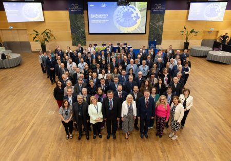
The first discussions took place at joint workshop between the POLKEN, which is part of the extensive knowledge exchange programme organised by the membership association for European NMCAs, and the UN-GGIM Working Group. The event was jointly hosted by National Geographic Institute, Belgium, the European Region of the UN Committee of Experts on Global Geospatial Information Management (UN-GGIM: Europe), and EuroGeographics.

Marjana Zelic, Senior Research and Policy Officer, EuroGeographics said: “We are delighted to share our network, which links different players within the wider data ecosystem, as well as our insights into EU policy, with our colleagues in the UN-GGIM Working Group. The collaboration is part of our on-going commitment to extending our knowledge exchange activities with the broader UN-GGIM community, and working in partnership with those who share our goal of using geospatial data for the public good.”

“By holding a joint workshop in Belgium, we have been able to maximise the participation and input from EuroGeographics members, relevant stakeholders and policy makers. This included discussions on the EU Artificial Intelligence (AI) Act with Kai Zenner, Head of Office and Digital Policy Adviser for Axel Voss MEP, who was involved in the political negotiations and provided deep insight on possible approaches to AI, and Katerina Yordanova, Senior Legal Expert at KU Leuven, who provided an overview of the latest developments.”

“We look forward to continuing our contributions to the paper being developed by the UN-GGIM Working Group.”

EuroGeographics has a letter of collaboration with the United Nations Statistics Division (UNSD) – the Secretariat of the UN Committee of Experts on Global Geospatial Information Management’s (UN-GGIM). As a result, the two organisations are working together to address key global challenges, specifically capacity development for the 2030 Agenda for Sustainable Development. The collaboration focuses on knowledge exchange as a key to unlocking the power of geospatial data for the benefit of people and planet.

EuroGeographics is an international not-for-profit organisation (AISBL/ IVZW under Belgian Law. BCE registration: 833 607 112) and the membership association for the European National Mapping, Cadastral and Land Registry Authorities.

EuroGeographics announces new Co-Chairs for Cadastre and Land Registry Network

EuroGeographics has named Jolien Neckebroeck from Belgium and Vents Priedoliņš from Latvia as new Co-Chairs of its Cadastre and Land Registry Network. 

Jolien, who is Head of the Valuations Department at the Belgian Cadastre, and Vents, who is Cadastre Development Manager at the State Land Service, Latvia, succeed Dr Daniel Steudler from the Federal Office of Topography (swisstopo) who has held the role since 2015.

Known as the CLR KEN, the expert group is part of the extensive knowledge exchange programme organised by the not-for-profit membership association for the European National Mapping, Cadastral and Land Registry Authorities. Together, Jolien and Vents will lead EuroGeographics’ collaboration with the EU Permanent Committee on Cadastre (PCC), the European Land Registry Association (ELRA), the European Land Information Service (EULIS) and the Council of European Geodetic Surveyors (CLGE) to establish a common vision for cooperation on cadastre and land registry.

Patricia Sokacova, Membership and Communications Manager, EuroGeographics and the Association’s contact for the CLR KEN said: “We are delighted to welcome Jolien and Vents as Co-Chairs of our expert group that provides the European platform for networking and sharing best practice. We would also like to sincerely thank Dr Steudler for the significant progress made under his leadership and his commitment to demonstrating the value of cadastral data.”

“Cadastral authorities and land registries fulfil an essential role by providing official, detailed, secure and reliable data on property rights and registration, and we look forward to working with Jolien and Vents to further our aim of meeting user needs for this fundamental information at both national and European levels.”

Members of EuroGeographics are working together to deliver pan-European open data through the Open Maps For Europe interface, including an Open Cadastral Map prototype. This currently provides large-scale coverage for six countries and is being enhanced by the Open Maps For Europe 2 (OME2) project, which is co-funded by the European Union.

The map takes INSPIRE open data and allows the user to find out what is available from national sources in one place before obtaining the data from the official provider. The cadastral map comprises four layers: Administrative Units, Cadastral Parcels (and Cadastral Zones), Buildings (and Building Parts) and Addresses.

EuroGeographics is an international not-for-profit organisation (AISBL/ IVZW under Belgian Law. BCE registration: 833 607 112) and the membership association for the European National Mapping, Cadastral and Land Registry Authorities.

The OME2 project is co-funded by the European Union. It is being delivered by a consortium comprising: EuroGeographics, the not-for-profit membership association for Europe’s National Mapping, Cadastral and Land Registration Authorities; National Geographic Institute, Belgium; National Institute of Geographic and Forest Information, France; Hellenic Cadastre; General Directorate for the Cadastre, Spain; and Cadastre, Land Registry and Agency, The Netherlands.

Views and opinions expressed are however those of the author only and do not necessarily reflect those of the European Union or European Commission. Neither the European Union nor the European Commission can be held responsible for them.

Open Maps For Europe was co-financed by the Connecting Europe Facility of the European Union and ended in 2022. It was coordinated by EuroGeographics, the voice of European National Mapping, Cadastral and Land Registration Authorities, in partnership with the National Geographic Institute (NGI) Belgium.

EuroGeographics showcases value of official national geospatial data in Copernicus Services

Land Monitoring and Emergency Management are among the Copernicus Services benefitting from the strengthened partnership between providers of official geospatial data and the European Environment Agency (EEA).

The framework agreement between the EEA and EuroGeographics, which represents Europe’s National Mapping, Cadastral and Land Registry Authorities, streamlines the licensing process to improve access to authoritative information. In doing so, it is increasing the number of datasets available via the Copernicus Reference Data Access (CORDA) database.

Four case studies from Albania, Spain, Germany and Iceland have now been published by EuroGeographics showing the value of official geospatial information for assessing flood and erosion risk, preventing the impact of extreme weather, and in contributing to the new European baseline for monitoring Land Cover and Land Use.

Angela Baker, Head of Partnerships and Sustainability, EuroGeographics said: “The Copernicus Services require reliable and accurate in-situ data to produce and validate their products. The new framework extends our agreement enabling the Copernicus Emergency Mapping Service to use members’ authoritative data to include the Copernicus Land Monitoring Service (CLMS) and the Copernicus Security Service (CSS).”

“Copernicus Services’ also have access to administrative boundary data through our agreement with Eurostat, as well as pan-European topographic, gazetteer and imagery datasets and services delivered through the Open Maps for Europe interface and the Open Maps For Europe 2 project (OME2).”

Jose Miguel Rubio Iglesias, responsible for the Copernicus In Situ component EEA added: “To meet end user requirements regarding data content and quality, Copernicus Services need access to open, up-to-date, and harmonised geospatial information across Europe. Data produced by the members of EuroGeographics is therefore key to its success.”

“Typically, geospatial data is relevant for all the different services, but we have identified three key services which require geospatial data: the Copernicus Emergency Service and its rapid mapping, and risk and recovery mapping components; the Copernicus Land Monitoring Service; and the Copernicus Security Service which supports, inter alia, the EU External Action Service.”

“As one of the Entrusted Entities implementing the Copernicus Land Monitoring Service (CLMS), the EEA is developing the CLC+ Suite of products. Authoritative data from NMCAs is also an important input to the CLC+ Backbone (the geospatial component of the CLC+ Suite of products) to complement the production and updating of satellite-data derived land cover data.”

“By working closely together, we can improve the use of authoritative data and services by Copernicus and ensure National Mapping, Cadastral and Land Registration Authorities are recognised for their essential contributions.”

The case studies focus on:

  • Albania where detailed elevation data provided to the Copernicus Emergency Management Service by the State Authority for Geospatial Information (ASIG), Albania was essential for assessing flood risk and its economic impact in the Drin river basin.
  • Germany where authoritative digital elevation and land cover data provided by the Federal Agency for Cartography and Geodesy (BKG), Germany is being used to better understand, predict and prevent future flooding caused by extreme weather.
  • Spain where transportation, Land Use and Land Cover data provided to the Copernicus Emergency Management Service by the National Geographic Institute of Spain played a key role in evaluating the impact of the 2022 Ceuta wildfire. It was also used to assess the risk of soil erosion in more than 130 hectares of forest in the Spanish autonomous city which is located on Africa’s north coast.
  • Iceland where the National Land Survey is contributing to the new European baseline for monitoring Land Cover and Land Use by providing access to geospatial data consisting of land cover and land use data, contour lines and height points, structures, boundaries, transportation, hydrology, coastal line, surface and place names.

 The case studies are available online.

EuroGeographics is an international not-for-profit organisation (AISBL/ IVZW under Belgian Law. BCE registration: 833 607 112) and the membership association for the European National Mapping, Cadastral and Land Registry Authorities.

The OME2 project is co-funded by the European Union. It is being delivered by a consortium comprising: EuroGeographics, the not-for-profit membership association for Europe’s National Mapping, Cadastral and Land Registration Authorities; National Geographic Institute, Belgium; National Institute of Geographic and Forest Information, France; Hellenic Cadastre; General Directorate for the Cadastre, Spain; and Cadastre, Land Registry and Agency, The Netherlands.

Views and opinions expressed are however those of the author only and do not necessarily reflect those of the European Union or European Commission. Neither the European Union nor the European Commission can be held responsible for them.

Open Maps For Europe was co-financed by the Connecting Europe Facility of the European Union and ended in 2022. It was coordinated by EuroGeographics, the voice of European National Mapping, Cadastral and Land Registration Authorities, in partnership with the National Geographic Institute (NGI) Belgium.

The Centre of Registers taking over the Forest Cadastre in Lithuania

The Centre of Registers, which maintains key national registers and information systems in Lithuania, has become the Data Processor of one more state system. On 1 January 2024, the Resolution of the Government of the Republic of Lithuania came into force and the Centre of Registers became the Data Processor of the State Cadastre of Forests of the Republic of Lithuania.

“The Centre of Registers has been maintaining the Real Property Cadastre and Register for many years where all basic data on the buildings and land parcels in the country is stored. Until the beginning of this year, information on forest land that could be found in separate state cadastres differed, areas of forests did not match, causing various problems and difficulties. After consolidating land parcel and forest data in one place, decision-making on the harmonisation of information in future will be possible. Therefore, the accuracy, relevance and reliability of data will be increased," says Kazys Maksvytis, Director of Registers Management at the State Enterprise Centre of Registers.

According to the Director of Registers Management, the Centre of Registers will make use of its experience in the management of cadastres and digitise the processes of preparation, registration and provision of data of the State Cadastre of Forests to customers. This will ensure a simpler and quicker access to and provision of all necessary information about the forests in the country.

Data to the State Cadastre of Forests is provided by forest managers (owners), persons performing state forest parcel inventory, developers of internal forest management projects, persons who initiated or organised the conversion of forest land into other lands (exceptional cases are provided for in the Law on Forests), specialists of the Environmental Protection Department and the State Forest Service.

The State Cadastre of Forests of the Republic of Lithuania is a specialised state cadastre established for accounting of forest land in the country and the management of forest data. The Forest Cadastre covers a whole set of data on Lithuanian forests, their ownership, quantity and quality of forest resources and economic value. It was established in 2003, and the Ministry of Environment is the Data Controller of the Forest Cadastre.

At present, more than 2 million hectares of forest land and almost 1.9 million forest inventory parcels are registered in the State Cadastre of Forests. This makes almost a third of the country’s territory.

The State Enterprise Centre of Registers creates and develops registers and information systems of national importance, processes their data and provides it to the data recipients. Currently, the Centre of Registers maintains 12 cadastres and registers of national importance (Real Property Cadastre and Register, Forest Cadastre, Register of Legal Entities, Population Register, Address Register, etc.) and 12 state information systems (Bailiffs’ Information System, e-Health, e-Delivery, e-Invoice, etc.).


EuroGeographics announces new Chair for Quality Knowledge Exchange Network

Jonathan Holmes, Data Management Lead, Ordnance Survey, congratulates Karin Mertens, Quality Control Manager, National Geographic Institute on becoming new Chair of EuroGeographics Quality Knowledge Exchange Network (QKEN).

EuroGeographics has named data quality expert, Karin Mertens from National Geographic Institute (NGI), Belgium as Chair of its Quality Knowledge Exchange Network (QKEN). 

Karin is Quality Control Manager at NGI. She succeeds Jonathan Holmes, Data Management Lead, Ordnance Survey, who has held the role since 2015.

The expert group is part of the extensive knowledge exchange programme organised by the not-for-profit membership association for the European National Mapping, Cadastral and Land Registry Authorities.

Carol Agius, Head of Representation and Stakeholder Engagement, EuroGeographics said: “Karin has extensive experience and expertise in ensuring the usability of geospatial data. We are delighted to welcome her as Chair of our quality expert group and would like to thank Jonathan for his committed leadership in its development over the last eight years.”

“As the national authorities for official geospatial information in Europe, high quality and reliability is the calling card of EuroGeographics members.The QKEN enables them to share expertise and best practice to ensure that their data continues to be trusted and the implementation of new technology does not impact on quality.”

“Our discussions also focus on ways to bring together data from multiple sources to ensure seamless, high-quality datasets and communicate the quality, relevance and content to users, in particular through the Open Maps For Europe 2 (OME2) Project. OME2 will develop a new production process and technical specification for free-to-use, edge-matched data under a single open licence.”

EuroGeographics is an international not-for-profit organisation (AISBL/ IVZW under Belgian Law. BCE registration: 833 607 112) and the membership association for the European National Mapping, Cadastral and Land Registry Authorities.

The OME2 project is co-funded by the European Union. It is being delivered by a consortium comprising: EuroGeographics, the not-for-profit membership association for Europe’s National Mapping, Cadastral and Land Registration Authorities; National Geographic Institute, Belgium; National Institute of Geographic and Forest Information, France; Hellenic Cadastre; General Directorate for the Cadastre, Spain; and Cadastre, Land Registry and Agency, The Netherlands.

Views and opinions expressed are however those of the author only and do not necessarily reflect those of the European Union or European Commission. Neither the European Union nor the European Commission can be held responsible for them.

Open Maps For Europe was co-financed by the Connecting Europe Facility of the European Union and ended in 2022. It was coordinated by EuroGeographics, the voice of European National Mapping, Cadastral and Land Registration Authorities, in partnership with the National Geographic Institute (NGI) Belgium.

EuroGeographics announces new Senior Management Team

EuroGeographics has announced a new Senior Management Team as part of its continued commitment to enable easy access to official pan-European geospatial data and expertise.

The Brussels-based not-for-profit organisation represents the European National Mapping, Cadastral and Land Registry Authorities.

The Senior Management Team, led by Secretary General and Executive Director, Sallie Payne-Snell, now comprises: Head of Representation and Stakeholder Engagement, Carol Agius; Head of Partnerships and Sustainability, Angela Baker; and Head of Finance and Administration, Paolo Ferraresi.

Sallie Payne-Snell said: “I am fortunate to lead a Head Office team with an in-depth understanding of the technological, legislative and operational challenges and opportunities facing members. By combining their professional knowledge, experience and expertise, they are committed to enabling a data-driven society empowered by the use of trusted maps, geospatial and land information from official sources.”

“I look forward to working with Carol, Angela and Paolo, each of whom bring skills that will contribute to our aim of enabling access to members’ high-value data and expertise for the public good.”

“Indeed, EuroGeographics and its members are already delivering high-value pan-European data through the Open Maps for Europe interface. We look forward to building on this success through the OME2 project, which is co-funded by the European Union and responds to user needs for large-scale open data.”

Head of Representation and Stakeholder Engagement, Carol Agius is responsible for activities within the European and global institutions, as well as an extensive knowledge exchange programme for members. In addition, she provides the Secretariat for the European regional committee of experts for global geospatial information management – UN-GGIM: Europe through EuroGeographics Service Level Agreement with The Netherlands’ Cadastre, Land Registry and Mapping Agency.

Carol is a geospatial professional with extensive international experience underpinned by practical expertise in policy development and implementation, and high-quality data production. She has two MScs, one in Strategic Quality Management and another in GIS, is a Fellow of the Royal Geographical Society, and a Chartered Geographer (GIS).

As Head of Partnerships and Sustainability, Angela Baker is responsible for data strategy and ensuring the EuroGeographics vision to facilitate access to members’ data continues to be realised in a way that ensures long-term sustainability.

Angela has extensive experience in harmonising data and licensing to overcome barriers to use and transform policy into practical action. She is a Fellow of the Royal Geographical Society, a Chartered Geographer, and has an MSc in Cartography and GIS.

Head of Finance and Administration, Paolo Ferraresi ensures compliance with fiscal and regulatory requirements. In addition to managing the Association’s finances, he has overall responsibility for HR and administrative activities.

Paolo brings broad experience in all aspects of financial management, including European projects and funding mechanisms. He has a Master’s Degree in Political Science, and has Diplomas in Business Administration and Management, and European Studies.

EuroGeographics is an international not-for-profit organisation (AISBL/ IVZW under Belgian Law. BCE registration: 833 607 112) and the membership association for the European National Mapping, Cadastral and Land Registry Authorities.

The OME2 project is co-funded by the European Union. It is being delivered by a consortium comprising: EuroGeographics, the not-for-profit membership association for Europe’s National Mapping, Cadastral and Land Registration Authorities; National Geographic Institute, Belgium; National Institute of Geographic and Forest Information, France; Hellenic Cadastre; General Directorate for the Cadastre, Spain; and Cadastre, Land Registry and Agency, The Netherlands.

Views and opinions expressed are however those of the author only and do not necessarily reflect those of the European Union or European Commission. Neither the European Union nor the European Commission can be held responsible for them.

Open Maps For Europe was co-financed by the Connecting Europe Facility of the European Union and ended in 2022. It was coordinated by EuroGeographics, the voice of European National Mapping, Cadastral and Land Registration Authorities, in partnership with the National Geographic Institute (NGI) Belgium.

Request for Tender – EuroGeographics Website

EuroGeographics is seeking qualified and experienced web development companies to submit proposals for the rebuilding of our website.

We invite interested companies to participate in a competitive tender process to help us enhance our online presence.

Interested companies should submit their proposals by the 5th of February.


Request for Tender


For inquiries and submission of proposals, please contact Alina Talipova

Thank you for your interest in working with us.

Copernicus Services: Contributing to the new European baseline for monitoring Land Cover and Land Use

As one of the Entrusted Entities implementing the Copernicus Land Monitoring Service (CLMS), the European Environment Agency (EEA) is developing the CLC+ Suite of products.

Authoritative data from National Mapping, Cadastral and Land Registration Authorities is important input to the CLC+ Backbone (the geospatial component of the CLC+ Suite of products) to complement the production and updating of satellite-data derived land cover data.

“We are delighted to provide data for CLC+ which plays a vital role in supporting key EU policy needs, as well as specific requirements for stakeholders in EU Member States. As a member of EuroGeographics, we fully support the partnership with the EEA to further explore solutions for providing full, free, and open access to geospatial data for the Copernicus programme.”
Gunnar Haukur Kristinsson, Director General, National Land Survey, Iceland

Read the full case study.

Season’s Greetings

Wishing Season's Greetings to our members, partners and everyone who contributes to #MapsForEurope.

We look forward to working with you again in 2024 to promote the use, and demonstrate the value of, members' authoritative high value data.