Importance of EU funding for pan-European authoritative geospatial data for Digital Europe’s Data Spaces
European Union (EU) funding is essential to ensure official pan-European geospatial data can be used in the development of Digital Europe’s Data Spaces.
In its response to the programme’s stakeholder consultation, EuroGeographics, the not-for-profit association for Europe’s National Mapping, Cadastral and Land Registration Authorities (NMCAs), has stressed that authoritative data is as important as the infrastructure upon which the data spaces will be built. It added that without appropriate longer-term funding mechanisms directly linked to EU policy areas, pan-European innovations, such as the award-winning Open Maps for Europe service, will not be feasible in the future.
Carol Agius, Head of Representation and Stakeholder Engagement, EuroGeographics said: “Digital Europe funding has enabled our members to deliver harmonised pan-European open data from more than 40 countries through the Open Maps For Europe project. By driving innovation, market development and growth to support the digital economy, this supports the Open Data and re-use of Public Sector Information (PSI) Directive.”
“Now, thanks to funding from the Digital Europe programme, we are continuing and enhancing this work through Open Maps for Europe 2 (OME2), which addresses the challenge of finding, easily accessing and licensing authoritative pan-European high-value geospatial data. Together with our members from Belgium, France, Greece, Spain and The Netherlands, we are part of the OME2 project consortium creating a new production process and technical specification to release a prototype for edge-matched, large-scale pan-European datasets covering 10 countries.”
“OME2 therefore directly supports the implementation of the European Strategy for Data – including the Open Data and re-use of PSI Directive, the opening of the high-value datasets, and the evolution of the INSPIRE Directive towards the GreenData4All initiative – and demonstrates how demand for geospatial information in all its common data spaces can be met.”
“Whilst organisations have a responsibility to be sustainable post-project, the challenge in relation to open data is securing the necessary funding to ensure the continuous release of up-to-date, harmonised and easily accessible information of at least the same or improved quality and quantity.”
“Programmes supporting digital transition, such as Digital Europe, should provide the solution so it is disappointing that the future strategic funding is linked to different policy areas; there is no mention of open data or the provision of data for the Data Spaces. As a result, it is difficult for EuroGeographics and its members to link any future activity to the Digital Europe programme. This will stifle innovation, in particular the development of large-scale, high-value pan-European data from the European NMCAs, which OME2 feedback indicates is a stakeholder requirement.”
“If the European Commission would like further innovations within the data areas, there must be appropriate funding mechanisms that are directly linked to EU policy areas.”
In its submission, EuroGeographics also asked that particular importance is placed on Digital Europe’s response to stakeholder needs, as well as how it is adapting to the data requirements of business, citizens, and public administrations. It recommends that particular emphasis is put on the pan-European data requirements of these groups, which is beyond the national remit of NMCAs.
Read EuroGeographics response to the Commission Call for Evidence for an Interim evaluation of the Digital Europe programme.
EuroGeographics is an international not-for-profit organisation (AISBL/ IVZW under Belgian Law. BCE registration: 833 607 112) and the membership association for the European National Mapping, Cadastral and Land Registry Authorities.
EuroGeographics is registered on the EU Transparency Register and bound by its code of conduct: TR 51080067776-74
The OME2 project is co-funded by the European Union. It is being delivered by a consortium comprising: EuroGeographics, the not-for-profit membership association for Europe’s National Mapping, Cadastral and Land Registration Authorities; National Geographic Institute, Belgium; National Institute of Geographic and Forest Information, France; Hellenic Cadastre; General Directorate for the Cadastre, Spain; and Cadastre, Land Registry and Mapping Agency, The Netherlands.
Views and opinions expressed are however those of the author only and do not necessarily reflect those of the European Union or European Commission. Neither the European Union nor the European Commission can be held responsible for them.


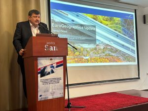
 Mr Petek also spoke to around 100 participants from 58 different institutions, both domestic and international, academic institutions and the private sector at the spatial data infrastructure days in Federation of Bosnia and Hercegovina.
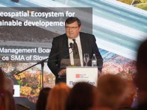