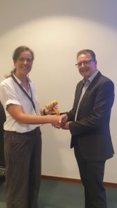
EuroGeographics announces new Senior Management Team
EuroGeographics has announced a new Senior Management Team as part of its continued commitment to enable easy access to official pan-European geospatial data and expertise.
The Brussels-based not-for-profit organisation represents the European National Mapping, Cadastral and Land Registry Authorities.
The Senior Management Team, led by Secretary General and Executive Director, Sallie Payne-Snell, now comprises: Head of Representation and Stakeholder Engagement, Carol Agius; Head of Partnerships and Sustainability, Angela Baker; and Head of Finance and Administration, Paolo Ferraresi.
Sallie Payne-Snell said: “I am fortunate to lead a Head Office team with an in-depth understanding of the technological, legislative and operational challenges and opportunities facing members. By combining their professional knowledge, experience and expertise, they are committed to enabling a data-driven society empowered by the use of trusted maps, geospatial and land information from official sources.”
“I look forward to working with Carol, Angela and Paolo, each of whom bring skills that will contribute to our aim of enabling access to members’ high-value data and expertise for the public good.”
“Indeed, EuroGeographics and its members are already delivering high-value pan-European data through the Open Maps for Europe interface. We look forward to building on this success through the OME2 project, which is co-funded by the European Union and responds to user needs for large-scale open data.”
Head of Representation and Stakeholder Engagement, Carol Agius is responsible for activities within the European and global institutions, as well as an extensive knowledge exchange programme for members. In addition, she provides the Secretariat for the European regional committee of experts for global geospatial information management – UN-GGIM: Europe through EuroGeographics Service Level Agreement with The Netherlands’ Cadastre, Land Registry and Mapping Agency.
Carol is a geospatial professional with extensive international experience underpinned by practical expertise in policy development and implementation, and high-quality data production. She has two MScs, one in Strategic Quality Management and another in GIS, is a Fellow of the Royal Geographical Society, and a Chartered Geographer (GIS).
As Head of Partnerships and Sustainability, Angela Baker is responsible for data strategy and ensuring the EuroGeographics vision to facilitate access to members’ data continues to be realised in a way that ensures long-term sustainability.
Angela has extensive experience in harmonising data and licensing to overcome barriers to use and transform policy into practical action. She is a Fellow of the Royal Geographical Society, a Chartered Geographer, and has an MSc in Cartography and GIS.
Head of Finance and Administration, Paolo Ferraresi ensures compliance with fiscal and regulatory requirements. In addition to managing the Association’s finances, he has overall responsibility for HR and administrative activities.
Paolo brings broad experience in all aspects of financial management, including European projects and funding mechanisms. He has a Master’s Degree in Political Science, and has Diplomas in Business Administration and Management, and European Studies.
EuroGeographics is an international not-for-profit organisation (AISBL/ IVZW under Belgian Law. BCE registration: 833 607 112) and the membership association for the European National Mapping, Cadastral and Land Registry Authorities.
The OME2 project is co-funded by the European Union. It is being delivered by a consortium comprising: EuroGeographics, the not-for-profit membership association for Europe’s National Mapping, Cadastral and Land Registration Authorities; National Geographic Institute, Belgium; National Institute of Geographic and Forest Information, France; Hellenic Cadastre; General Directorate for the Cadastre, Spain; and Cadastre, Land Registry and Agency, The Netherlands.
Views and opinions expressed are however those of the author only and do not necessarily reflect those of the European Union or European Commission. Neither the European Union nor the European Commission can be held responsible for them.
Open Maps For Europe was co-financed by the Connecting Europe Facility of the European Union and ended in 2022. It was coordinated by EuroGeographics, the voice of European National Mapping, Cadastral and Land Registration Authorities, in partnership with the National Geographic Institute (NGI) Belgium.

 The OME2 project is co-funded by the European Union. Views and opinions expressed are however those of the author only and do not necessarily reflect those of the European Union or European Commission. Neither the European Union nor the European Commission can be held responsible for them.