Open Maps For Europe (OME) 2 project announces plans for pan-European Cadastral Data Strategy

Plans to develop a strategy that will increase the use of European cadastral data by making it more findable and accessible have been announced by the Open Maps For Europe 2 (OME2) Project.

The pan-European Cadastral Data Strategy will define stakeholders as well as the technology, processes, resources and best practices required to support the long-term delivery of official high-value data for addresses, cadastral parcels, buildings and administrative units.

The OME2 Project is enhancing the Open Cadastral Map prototype, which is available through the Open Maps For Europe interface and currently provides large-scale coverage for six countries. The cadastral map comprises four layers: Administrative Units, Cadastral Parcels (and Cadastral Zones), Buildings (and Building Parts) and Addresses. It compiles and harmonises INSPIRE open data to provide users with an overview of the information available, and user-friendly links for downloading it directly from the data providers’ national geoportals.

Ms Hara Papadaki is one of the team of experts from the Hellenic Cadastre who are working with the General Directorate on Cadastre Spain to develop this key Project deliverable.

She said: “Our vision is that the Open Cadastral Map becomes a single point to access pan-European high-value cadastral data enabling users to easily find authoritative information. To do this, we are developing common processes, guidelines and best practices, aligned to key European and global policies, for integrating data from National Mapping, Cadastral and Land Registration Authorities.”

“Whilst INSPIRE sets some common regulations which help to streamline existing data from those countries that comply with the Directive, we have developed further specifications for our production process to achieve harmonisation. This includes requirements for INSPIRE endorsed gml schema, INSPIRE ATOM Feed Service for download, and ETRS 89 Coordinate Reference System. Our aim is to establish a process that delivers up to date, quality, authoritative cadastral data that is both easy to use and combine with other information.”

“For example, linking location with other datasets provides new insights and opportunities to inform decisions and operations, thus unlocking value and enabling more complex data transactions.”

Ms Papadaki concluded by urging NMCAs to take advantage of the opportunity to promote the value of their expertise and information.

She said: “Projects such as OME2 demonstrate our eagerness and competence to collaborate across sectors and national boundaries. By adjusting our operations and business models to reflect changes at international, as well as national and European level, we can be core agents in the implementation of important and high-profile initiatives, including the UN-endorsed Integrated Geospatial Information Framework (IGIF) and the open and high value data.”

Plans for the pan-European Cadastral Data Strategy were presented at a recent workshop on Sustainable Business Models for NMCAs jointly organised by EuroSDR and EuroGeographics, which represents official national providers of geospatial information in Europe.

The OME2 project is co-funded by the European Union. It is being delivered by a consortium comprising: EuroGeographics, the not-for-profit membership association for Europe’s National Mapping, Cadastral and Land Registration Authorities; National Geographic Institute, Belgium; National Institute of Geographic and Forest Information, France; Hellenic Cadastre; General Directorate for the Cadastre, Spain; and Cadastre, Land Registry and Agency, The Netherlands.

It runs until the end of 2025.

EuroGeographics is an international not-for-profit organisation (AISBL/ IVZW under Belgian Law. BCE registration: 833 607 112) and the membership association for the European National Mapping, Cadastral and Land Registry Authorities.

To find out more about EuroGeographics, please visit www.eurogeographics.org

The OME2 project is co-funded by the European Union. Views and opinions expressed are however those of the author only and do not necessarily reflect those of the European Union or European Commission. Neither the European Union nor the European Commission can be held responsible for them.

Open Maps For Europe was co-financed by the Connecting Europe Facility of the European Union and ended in 2022. It was coordinated by EuroGeographics, the voice of European National Mapping, Cadastral and Land Registration Authorities, in partnership with the National Geographic Institute (NGI) Belgium.

European Policy experts share insights for UN paper on authoritative geospatial data for disaster risk reduction and crisis management

Policy experts from European National Mapping, Cadastral and Land Registration Authorities (NMCAs) are contributing to a new United Nation’s paper on authoritative geospatial data for disaster risk reduction and crisis management.

EuroGeographics’ Policy Network (POLKEN) is providing the UN-GGIM Working Group on Policy and Legal Frameworks for Geospatial Information Management with case studies to demonstrate the value of trusted information from official national sources.

The first discussions took place at joint workshop between the POLKEN, which is part of the extensive knowledge exchange programme organised by the membership association for European NMCAs, and the UN-GGIM Working Group. The event was jointly hosted by National Geographic Institute, Belgium, the European Region of the UN Committee of Experts on Global Geospatial Information Management (UN-GGIM: Europe), and EuroGeographics.

Marjana Zelic, Senior Research and Policy Officer, EuroGeographics said: “We are delighted to share our network, which links different players within the wider data ecosystem, as well as our insights into EU policy, with our colleagues in the UN-GGIM Working Group. The collaboration is part of our on-going commitment to extending our knowledge exchange activities with the broader UN-GGIM community, and working in partnership with those who share our goal of using geospatial data for the public good.”

“By holding a joint workshop in Belgium, we have been able to maximise the participation and input from EuroGeographics members, relevant stakeholders and policy makers. This included discussions on the EU Artificial Intelligence (AI) Act with Kai Zenner, Head of Office and Digital Policy Adviser for Axel Voss MEP, who was involved in the political negotiations and provided deep insight on possible approaches to AI, and Katerina Yordanova, Senior Legal Expert at KU Leuven, who provided an overview of the latest developments.”

“We look forward to continuing our contributions to the paper being developed by the UN-GGIM Working Group.”

EuroGeographics has a letter of collaboration with the United Nations Statistics Division (UNSD) – the Secretariat of the UN Committee of Experts on Global Geospatial Information Management’s (UN-GGIM). As a result, the two organisations are working together to address key global challenges, specifically capacity development for the 2030 Agenda for Sustainable Development. The collaboration focuses on knowledge exchange as a key to unlocking the power of geospatial data for the benefit of people and planet.

EuroGeographics is an international not-for-profit organisation (AISBL/ IVZW under Belgian Law. BCE registration: 833 607 112) and the membership association for the European National Mapping, Cadastral and Land Registry Authorities.

EuroGeographics announces new Co-Chairs for Cadastre and Land Registry Network

EuroGeographics has named Jolien Neckebroeck from Belgium and Vents Priedoliņš from Latvia as new Co-Chairs of its Cadastre and Land Registry Network. 

Jolien, who is Head of the Valuations Department at the Belgian Cadastre, and Vents, who is Cadastre Development Manager at the State Land Service, Latvia, succeed Dr Daniel Steudler from the Federal Office of Topography (swisstopo) who has held the role since 2015.

Known as the CLR KEN, the expert group is part of the extensive knowledge exchange programme organised by the not-for-profit membership association for the European National Mapping, Cadastral and Land Registry Authorities. Together, Jolien and Vents will lead EuroGeographics’ collaboration with the EU Permanent Committee on Cadastre (PCC), the European Land Registry Association (ELRA), the European Land Information Service (EULIS) and the Council of European Geodetic Surveyors (CLGE) to establish a common vision for cooperation on cadastre and land registry.

Patricia Sokacova, Membership and Communications Manager, EuroGeographics and the Association’s contact for the CLR KEN said: “We are delighted to welcome Jolien and Vents as Co-Chairs of our expert group that provides the European platform for networking and sharing best practice. We would also like to sincerely thank Dr Steudler for the significant progress made under his leadership and his commitment to demonstrating the value of cadastral data.”

“Cadastral authorities and land registries fulfil an essential role by providing official, detailed, secure and reliable data on property rights and registration, and we look forward to working with Jolien and Vents to further our aim of meeting user needs for this fundamental information at both national and European levels.”

Members of EuroGeographics are working together to deliver pan-European open data through the Open Maps For Europe interface, including an Open Cadastral Map prototype. This currently provides large-scale coverage for six countries and is being enhanced by the Open Maps For Europe 2 (OME2) project, which is co-funded by the European Union.

The map takes INSPIRE open data and allows the user to find out what is available from national sources in one place before obtaining the data from the official provider. The cadastral map comprises four layers: Administrative Units, Cadastral Parcels (and Cadastral Zones), Buildings (and Building Parts) and Addresses.

EuroGeographics is an international not-for-profit organisation (AISBL/ IVZW under Belgian Law. BCE registration: 833 607 112) and the membership association for the European National Mapping, Cadastral and Land Registry Authorities.

The OME2 project is co-funded by the European Union. It is being delivered by a consortium comprising: EuroGeographics, the not-for-profit membership association for Europe’s National Mapping, Cadastral and Land Registration Authorities; National Geographic Institute, Belgium; National Institute of Geographic and Forest Information, France; Hellenic Cadastre; General Directorate for the Cadastre, Spain; and Cadastre, Land Registry and Agency, The Netherlands.

Views and opinions expressed are however those of the author only and do not necessarily reflect those of the European Union or European Commission. Neither the European Union nor the European Commission can be held responsible for them.
Open Maps For Europe was co-financed by the Connecting Europe Facility of the European Union and ended in 2022. It was coordinated by EuroGeographics, the voice of European National Mapping, Cadastral and Land Registration Authorities, in partnership with the National Geographic Institute (NGI) Belgium.

EuroGeographics showcases value of official national geospatial data in Copernicus Services

Land Monitoring and Emergency Management are among the Copernicus Services benefitting from the strengthened partnership between providers of official geospatial data and the European Environment Agency (EEA).

The framework agreement between the EEA and EuroGeographics, which represents Europe’s National Mapping, Cadastral and Land Registry Authorities, streamlines the licensing process to improve access to authoritative information. In doing so, it is increasing the number of datasets available via the Copernicus Reference Data Access (CORDA) database.

Four case studies from Albania, Spain, Germany and Iceland have now been published by EuroGeographics showing the value of official geospatial information for assessing flood and erosion risk, preventing the impact of extreme weather, and in contributing to the new European baseline for monitoring Land Cover and Land Use.

Angela Baker, Head of Partnerships and Sustainability, EuroGeographics said: “The Copernicus Services require reliable and accurate in-situ data to produce and validate their products. The new framework extends our agreement enabling the Copernicus Emergency Mapping Service to use members’ authoritative data to include the Copernicus Land Monitoring Service (CLMS) and the Copernicus Security Service (CSS).”

“Copernicus Services’ also have access to administrative boundary data through our agreement with Eurostat, as well as pan-European topographic, gazetteer and imagery datasets and services delivered through the Open Maps for Europe interface and the Open Maps For Europe 2 project (OME2).”

Jose Miguel Rubio Iglesias, responsible for the Copernicus In Situ component EEA added: “To meet end user requirements regarding data content and quality, Copernicus Services need access to open, up-to-date, and harmonised geospatial information across Europe. Data produced by the members of EuroGeographics is therefore key to its success.”

“Typically, geospatial data is relevant for all the different services, but we have identified three key services which require geospatial data: the Copernicus Emergency Service and its rapid mapping, and risk and recovery mapping components; the Copernicus Land Monitoring Service; and the Copernicus Security Service which supports, inter alia, the EU External Action Service.”

“As one of the Entrusted Entities implementing the Copernicus Land Monitoring Service (CLMS), the EEA is developing the CLC+ Suite of products. Authoritative data from NMCAs is also an important input to the CLC+ Backbone (the geospatial component of the CLC+ Suite of products) to complement the production and updating of satellite-data derived land cover data.”

“By working closely together, we can improve the use of authoritative data and services by Copernicus and ensure National Mapping, Cadastral and Land Registration Authorities are recognised for their essential contributions.”

The case studies focus on:

  • Albania where detailed elevation data provided to the Copernicus Emergency Management Service by the State Authority for Geospatial Information (ASIG), Albania was essential for assessing flood risk and its economic impact in the Drin river basin.
  • Germany where authoritative digital elevation and land cover data provided by the Federal Agency for Cartography and Geodesy (BKG), Germany is being used to better understand, predict and prevent future flooding caused by extreme weather.
  • Spain where transportation, Land Use and Land Cover data provided to the Copernicus Emergency Management Service by the National Geographic Institute of Spain played a key role in evaluating the impact of the 2022 Ceuta wildfire. It was also used to assess the risk of soil erosion in more than 130 hectares of forest in the Spanish autonomous city which is located on Africa’s north coast.
  • Iceland where the National Land Survey is contributing to the new European baseline for monitoring Land Cover and Land Use by providing access to geospatial data consisting of land cover and land use data, contour lines and height points, structures, boundaries, transportation, hydrology, coastal line, surface and place names.

 The case studies are available online.

EuroGeographics is an international not-for-profit organisation (AISBL/ IVZW under Belgian Law. BCE registration: 833 607 112) and the membership association for the European National Mapping, Cadastral and Land Registry Authorities.

The OME2 project is co-funded by the European Union. It is being delivered by a consortium comprising: EuroGeographics, the not-for-profit membership association for Europe’s National Mapping, Cadastral and Land Registration Authorities; National Geographic Institute, Belgium; National Institute of Geographic and Forest Information, France; Hellenic Cadastre; General Directorate for the Cadastre, Spain; and Cadastre, Land Registry and Agency, The Netherlands.

Views and opinions expressed are however those of the author only and do not necessarily reflect those of the European Union or European Commission. Neither the European Union nor the European Commission can be held responsible for them.
Open Maps For Europe was co-financed by the Connecting Europe Facility of the European Union and ended in 2022. It was coordinated by EuroGeographics, the voice of European National Mapping, Cadastral and Land Registration Authorities, in partnership with the National Geographic Institute (NGI) Belgium.

EuroGeographics announces new Chair for Quality Knowledge Exchange Network

Jonathan Holmes, Data Management Lead, Ordnance Survey, congratulates Karin Mertens, Quality Control Manager, National Geographic Institute on becoming new Chair of EuroGeographics Quality Knowledge Exchange Network (QKEN).

EuroGeographics has named data quality expert, Karin Mertens from National Geographic Institute (NGI), Belgium as Chair of its Quality Knowledge Exchange Network (QKEN). 

Karin is Quality Control Manager at NGI. She succeeds Jonathan Holmes, Data Management Lead, Ordnance Survey, who has held the role since 2015.

The expert group is part of the extensive knowledge exchange programme organised by the not-for-profit membership association for the European National Mapping, Cadastral and Land Registry Authorities.

Carol Agius, Head of Representation and Stakeholder Engagement, EuroGeographics said: “Karin has extensive experience and expertise in ensuring the usability of geospatial data. We are delighted to welcome her as Chair of our quality expert group and would like to thank Jonathan for his committed leadership in its development over the last eight years.”

“As the national authorities for official geospatial information in Europe, high quality and reliability is the calling card of EuroGeographics members.The QKEN enables them to share expertise and best practice to ensure that their data continues to be trusted and the implementation of new technology does not impact on quality.”

“Our discussions also focus on ways to bring together data from multiple sources to ensure seamless, high-quality datasets and communicate the quality, relevance and content to users, in particular through the Open Maps For Europe 2 (OME2) Project. OME2 will develop a new production process and technical specification for free-to-use, edge-matched data under a single open licence.”

EuroGeographics is an international not-for-profit organisation (AISBL/ IVZW under Belgian Law. BCE registration: 833 607 112) and the membership association for the European National Mapping, Cadastral and Land Registry Authorities.

The OME2 project is co-funded by the European Union. It is being delivered by a consortium comprising: EuroGeographics, the not-for-profit membership association for Europe’s National Mapping, Cadastral and Land Registration Authorities; National Geographic Institute, Belgium; National Institute of Geographic and Forest Information, France; Hellenic Cadastre; General Directorate for the Cadastre, Spain; and Cadastre, Land Registry and Agency, The Netherlands.

Views and opinions expressed are however those of the author only and do not necessarily reflect those of the European Union or European Commission. Neither the European Union nor the European Commission can be held responsible for them.
Open Maps For Europe was co-financed by the Connecting Europe Facility of the European Union and ended in 2022. It was coordinated by EuroGeographics, the voice of European National Mapping, Cadastral and Land Registration Authorities, in partnership with the National Geographic Institute (NGI) Belgium.

EuroGeographics announces new Senior Management Team

EuroGeographics has announced a new Senior Management Team as part of its continued commitment to enable easy access to official pan-European geospatial data and expertise.

The Brussels-based not-for-profit organisation represents the European National Mapping, Cadastral and Land Registry Authorities.

The Senior Management Team, led by Secretary General and Executive Director, Sallie Payne-Snell, now comprises: Head of Representation and Stakeholder Engagement, Carol Agius; Head of Partnerships and Sustainability, Angela Baker; and Head of Finance and Administration, Paolo Ferraresi.

Sallie Payne-Snell said: “I am fortunate to lead a Head Office team with an in-depth understanding of the technological, legislative and operational challenges and opportunities facing members. By combining their professional knowledge, experience and expertise, they are committed to enabling a data-driven society empowered by the use of trusted maps, geospatial and land information from official sources.”

“I look forward to working with Carol, Angela and Paolo, each of whom bring skills that will contribute to our aim of enabling access to members’ high-value data and expertise for the public good.”

“Indeed, EuroGeographics and its members are already delivering high-value pan-European data through the Open Maps for Europe interface. We look forward to building on this success through the OME2 project, which is co-funded by the European Union and responds to user needs for large-scale open data.”

Head of Representation and Stakeholder Engagement, Carol Agius is responsible for activities within the European and global institutions, as well as an extensive knowledge exchange programme for members. In addition, she provides the Secretariat for the European regional committee of experts for global geospatial information management – UN-GGIM: Europe through EuroGeographics Service Level Agreement with The Netherlands’ Cadastre, Land Registry and Mapping Agency.

Carol is a geospatial professional with extensive international experience underpinned by practical expertise in policy development and implementation, and high-quality data production. She has two MScs, one in Strategic Quality Management and another in GIS, is a Fellow of the Royal Geographical Society, and a Chartered Geographer (GIS).

As Head of Partnerships and Sustainability, Angela Baker is responsible for data strategy and ensuring the EuroGeographics vision to facilitate access to members’ data continues to be realised in a way that ensures long-term sustainability.

Angela has extensive experience in harmonising data and licensing to overcome barriers to use and transform policy into practical action. She is a Fellow of the Royal Geographical Society, a Chartered Geographer, and has an MSc in Cartography and GIS.

Head of Finance and Administration, Paolo Ferraresi ensures compliance with fiscal and regulatory requirements. In addition to managing the Association’s finances, he has overall responsibility for HR and administrative activities.

Paolo brings broad experience in all aspects of financial management, including European projects and funding mechanisms. He has a Master’s Degree in Political Science, and has Diplomas in Business Administration and Management, and European Studies.

EuroGeographics is an international not-for-profit organisation (AISBL/ IVZW under Belgian Law. BCE registration: 833 607 112) and the membership association for the European National Mapping, Cadastral and Land Registry Authorities.

The OME2 project is co-funded by the European Union. It is being delivered by a consortium comprising: EuroGeographics, the not-for-profit membership association for Europe’s National Mapping, Cadastral and Land Registration Authorities; National Geographic Institute, Belgium; National Institute of Geographic and Forest Information, France; Hellenic Cadastre; General Directorate for the Cadastre, Spain; and Cadastre, Land Registry and Agency, The Netherlands.

Views and opinions expressed are however those of the author only and do not necessarily reflect those of the European Union or European Commission. Neither the European Union nor the European Commission can be held responsible for them.
Open Maps For Europe was co-financed by the Connecting Europe Facility of the European Union and ended in 2022. It was coordinated by EuroGeographics, the voice of European National Mapping, Cadastral and Land Registration Authorities, in partnership with the National Geographic Institute (NGI) Belgium.

Data quality top priority as national providers of geospatial information adopt pragmatic approach to AI

Artificial intelligence (AI) is an opportunity to improve efficiency but data quality must be maintained to ensure accuracy is not compromised, say national providers of geospatial information.

More than half of the participants in third joint EuroGeographics – EuroSDR workshop said they were testing AI, or confirmed its small scale or moderate use within their organisations. They also identified machine learning as the most relevant technology for their activities, and cited security and accuracy as key issues that AI policy frameworks should consider.

“There is no doubt that AI is a technological game changer, indeed the majority of delegates agreed that it is inevitable that they would be using it extensively in the near future,” said Carol Agius, Head of Representation and Stakeholder Engagement, EuroGeographics which represents Europe’s National Mapping, Cadastral and Land Registry Authorities (NMCAs).

“As trusted providers of official geospatial information, the challenge for our members is to balance efficiency benefits with measures to ensure the continued accuracy, high quality and reliability of their data. Our discussions show that they are taking a prudent and pragmatic approach to the use of AI rather than falling for the hype.”

Joep Crompvoets, Secretary General of EuroSDR added: “The workshop’s discussions show that AI is not a silver bullet but a complimentary tool for the traditional methods used by NMCAs. To gain maximum benefit, they should invest in and use the technology by adopting a culture of GeoAI throughout their organisation.”

The 2023 workshop was organised by not-for-profit organisations, EuroGeographics, and EuroSDR, the European Spatial Data Research network that links NMCAs with Research Institutes and Universities.

It continued the conversation of AI within the context of NMCAs from events held in 2021 and 2022, and brought together producers, users, academia and software suppliers to debate spatial data quality, with a particular focus on the impact of new technologies.

Presentations are available here.

EuroGeographics is an international not-for-profit organisation (AISBL/ IVZW under Belgian Law. BCE registration: 833 607 112) and the membership association for the European National Mapping, Cadastral and Land Registry Authorities.

Role of trusted location data pinpointed as valuable resource to build a better future for all

Data from official national sources is one of Europe’s most valuable resources in achieving a sustainable, safer and fairer society, MEPs have heard.

Cristian Bușoi, MEP and Chair of Committee on Industry, Research and Energy (ITRE) highlights the importance of trusted data for the SDGs.

The showcase by members of EuroGeographics, the not-for-profit membership association for Europe’s National Mapping, Cadastral and Land Registry Authorities, highlighted their role providing fundamental information to implement the United Nations’ Sustainable Development Goals (SDGs). It featured examples from Belgium, France, Germany and The Netherlands to demonstrate how location connects people with place for sustainable development, tackling climate change, creating digital twins, and developing intelligent transport systems.

Opening the event in the European Parliament, host Cristian Bușoi, MEP and Chair of Committee on Industry, Research and Energy (ITRE) said: “Data holds tremendous importance for implementation of the SDGs; it enables us to monitor progress and shows us precisely where to intervene to gain momentum.”

“I commend the commitment of EuroGeographics, national geospatial information providers, and the UN-GGIM: Europe Executive Committee, to shape a stronger and more inclusive post 2030 development framework.”

“The European Union is putting great effort into enabling European citizens to live in dignity and peace, in a clean environment, and in economic prosperity. Full implementation of the UN’s 2030 Agenda is crucial to strengthen resilience and prepare for future potential shocks as we embark on the twin green and digital transitions.”

Colin Bray, President of EuroGeographics said: “The UN recognises that a strong global geospatial infrastructure is an essential enabler for achieving its 2030 Agenda.”

“To fully realise the benefits, we encourage even greater use of official geospatial data for the global indicators of the SDGs. And we strongly believe that geospatial information should be an integral component of the next development framework.”

“The Sustainable Development Goals Report 2023 Special Edition highlights data challenges, calls for more inclusive data for development, and states the need to strengthen coordination within national data ecosystems. The UN-endorsed Integrated Geospatial Information Framework – or IGIF, which is being implemented by many of our members, helps to address these issues.”

“The EuroGeographics-led project, Open Maps For Europe 2 (OME2) supports the ambitions of the IGIF by aligning the technical specifications for large-scale open data with the core recommendations for content proposed by UN-GGIM: Europe.”

OME2 provides a foundation for future pan-European high-value datasets. It is developing a new production process and technical specification for free-to-use, edge-matched, interoperable data under a single open licence to create a prototype dataset covering 10 countries. The data will be delivered via the user interface built by the award-winning Open Maps For Europe project which was completed in 2022. The two-year project is co-funded by the European Union.

Tomaz Petek, Chair of the European regional committee of experts for United Nations Global Geospatial Information Management – UN-GGIM: Europe, added: “Our work on the Sustainable Development Goals showcases the added value of integrating geospatial information with other data to address the indicators, and provides technical and methodological solutions for common challenges.”

“The integration of geospatial data in the next development framework will not only make it stronger and more inclusive, but will also help realise the aspirations held by people around the world for a better future. UN-GGIM: Europe is committed to playing its part in accelerating the achievement of the Sustainable Development Goals for present and future generations, turning our world towards a sustainable and resilient path by 2030.”

Mr Bray concluded: “Together with our members, we believe in a society empowered by the use of trusted geospatial data and services. Data from official national sources is therefore one of Europe’s most valuable resources in gaining momentum towards a sustainable, safer and fairer society.”

EuroGeographics is an international not-for-profit organisation (AISBL/ IVZW under Belgian Law. BCE registration: 833 607 112) and the membership association for the European National Mapping, Cadastral and Land Registry Authorities.

OME2 is co-funded by the European Union.

It is being delivered by a consortium comprising: EuroGeographics; National Geographic Institute, Belgium; National Institute of Geographic and Forest Information, France; Hellenic Cadastre; General Directorate for the Cadastre, Spain; and Cadastre, Land Registry and Mapping Agency, The Netherlands.

Open Maps For Europe ended in 2022. It was co-financed by the Connecting Europe Facility of the European Union, and coordinated by EuroGeographics in partnership with the National Geographic Institute (NGI) Belgium.

The contents of this publication are the sole responsibility of EuroGeographics and do not necessarily reflect the opinion of the European Union.

New head of EuroGeographics to focus on enabling access to high-value geospatial data from official national sources

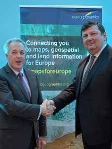
Sallie Payne Snell, Secretary General and Executive Director of EuroGeographics

Sallie Payne Snell has been appointed Secretary General and Executive Director of EuroGeographics

EuroGeographics has today (12 October 2023) announced Sallie Payne Snell as its new Secretary General and Executive Director.

Sallie, who previously led operations at the not-for-profit membership association, has an in-depth understanding of the technological, legislative and operational challenges and opportunities facing National Mapping, Cadastral and Land Information Authorities.

Commenting on her appointment, she said: “It is a privilege to represent official providers of the trusted geospatial information that is fundamental to the everyday lives of people across Europe.”

“My focus is on enabling access to members’ high-value data and expertise for the public good through its integration into the infrastructures we rely upon as a modern society.”

“EuroGeographics and its members are already delivering high-value pan-European data through the Open Maps for Europe interface. We look forward to building on this success through the OME2 project, which is co-funded by the European Union and responds to user needs for large-scale open data.”

President of EuroGeographics, Colin Bray added: “We are delighted that Sallie will lead EuroGeographics as we take our next steps in realising its vision of a society empowered by the use of trusted geospatial services from official national sources.”

“Sallie is a great champion of members’ data and expertise, and her extensive experience in relationship management will be key to further establishing partnerships with those who share our goal of using geospatial data for the public good. These collaborations are vital for meeting user requirements and finding solutions to common challenges.”

Sallie’s previous positions include Deputy Director, Association for Geographic Information, and International Stakeholder Relationship Manager, Ordnance Survey.  She holds a BSc in geographical science.

EuroGeographics is an international not-for-profit organisation (AISBL/ IVZW under Belgian Law. BCE registration: 833 607 112) and the membership association for the European National Mapping, Cadastral and Land Registry Authorities.

The OME2 project is co-funded by the European Union. It is being delivered by a consortium comprising: EuroGeographics, the not-for-profit membership association for Europe’s National Mapping, Cadastral and Land Registration Authorities; National Geographic Institute, Belgium; National Institute of Geographic and Forest Information, France; Hellenic Cadastre; General Directorate for the Cadastre, Spain; and Cadastre, Land Registry and Mapping Agency, The Netherlands.

Views and opinions expressed are however those of the author only and do not necessarily reflect those of the European Union or European Commission. Neither the European Union nor the European Commission can be held responsible for them.
Open Maps For Europe was co-financed by the Connecting Europe Facility of the European Union and ended in 2022. It was coordinated by EuroGeographics, the voice of European National Mapping, Cadastral and Land Registration Authorities, in partnership with the National Geographic Institute (NGI) Belgium.

EuroGeographics calls for integration of trusted geospatial data in next global development framework

Geospatial data should be integrated into the next development framework to strengthen and make it more inclusive beyond the 2030 Agenda, says EuroGeographics.

The not-for-profit membership association for European National Mapping, Cadastral and Land Registration Authorities was speaking at the thirteenth session of the United Nations Committee of Experts on Global Geospatial Information Management (UN-GGIM).

During a series of interventions, EuroGeographics reiterated its commitment to sharing its extensive knowledge exchange network with the Committee, as well as offering support in facilitating access to official high-value European geospatial data and demonstrating its contribution to the public good. The Association also welcomed a new paper on authoritative data by UN-GGIM’s Working Group on Policy and Legal Frameworks for Geospatial Information, adding that it provides a thorough global understanding of the meaning.

“As the Member Association representing the European organisations nationally mandated to produce geospatial information, we strongly believe in a society empowered by trusted authoritative data from official national sources,” said Sallie Payne Snell, Acting Secretary General and Executive Director, EuroGeographics.

“Our collaboration with the United Nations Statistical Division provides a platform for sharing expertise and experience to unlock the power of geospatial data to benefit people and planet. We have extensive experience in establishing partnerships with those who share our goal and, to further support the Committee’s activities, we are committed to providing access to our knowledge exchange programme which links different players within the wider data ecosystem.”

Carol Agius, Head of Representation and Stakeholder Engagement, EuroGeographics, added: “The Sustainable Development Goals (SDGs) Report 2023 Special Edition highlights the data challenge for the SDGs and calls for more inclusive data for development. We agree with the Committee of Experts that more effort should be invested in coordinating and collating data for the SDGs to address both the information and digital divide.”

“As national providers of official geospatial information in Europe, our members’ data enables the connection between people and place, and plays a key role in measuring where progress is, or is not, being made. EuroGeographics therefore suggests to the Committee of Experts that geospatial data should be an integral component of the next development framework, and offers its support in enabling access to official high-value European geospatial data, sharing expertise and best practice, and demonstrating the use and value of location to provide a stronger and more inclusive development framework beyond the 2030 Agenda. “

EuroGeographics is an international not-for-profit organisation (AISBL/ IVZW under Belgian Law. BCE registration: 833 607 112) and the membership association for the European National Mapping, Cadastral and Land Registry Authorities.