Open Maps For Europe (OME) 2 project announces plans for pan-European Cadastral Data Strategy
Plans to develop a strategy that will increase the use of European cadastral data by making it more findable and accessible have been announced by the Open Maps For Europe 2 (OME2) Project.
The pan-European Cadastral Data Strategy will define stakeholders as well as the technology, processes, resources and best practices required to support the long-term delivery of official high-value data for addresses, cadastral parcels, buildings and administrative units.
The OME2 Project is enhancing the Open Cadastral Map prototype, which is available through the Open Maps For Europe interface and currently provides large-scale coverage for six countries. The cadastral map comprises four layers: Administrative Units, Cadastral Parcels (and Cadastral Zones), Buildings (and Building Parts) and Addresses. It compiles and harmonises INSPIRE open data to provide users with an overview of the information available, and user-friendly links for downloading it directly from the data providers’ national geoportals.
Ms Hara Papadaki is one of the team of experts from the Hellenic Cadastre who are working with the General Directorate on Cadastre Spain to develop this key Project deliverable.
She said: “Our vision is that the Open Cadastral Map becomes a single point to access pan-European high-value cadastral data enabling users to easily find authoritative information. To do this, we are developing common processes, guidelines and best practices, aligned to key European and global policies, for integrating data from National Mapping, Cadastral and Land Registration Authorities.”
“Whilst INSPIRE sets some common regulations which help to streamline existing data from those countries that comply with the Directive, we have developed further specifications for our production process to achieve harmonisation. This includes requirements for INSPIRE endorsed gml schema, INSPIRE ATOM Feed Service for download, and ETRS 89 Coordinate Reference System. Our aim is to establish a process that delivers up to date, quality, authoritative cadastral data that is both easy to use and combine with other information.”
“For example, linking location with other datasets provides new insights and opportunities to inform decisions and operations, thus unlocking value and enabling more complex data transactions.”
Ms Papadaki concluded by urging NMCAs to take advantage of the opportunity to promote the value of their expertise and information.
She said: “Projects such as OME2 demonstrate our eagerness and competence to collaborate across sectors and national boundaries. By adjusting our operations and business models to reflect changes at international, as well as national and European level, we can be core agents in the implementation of important and high-profile initiatives, including the UN-endorsed Integrated Geospatial Information Framework (IGIF) and the open and high value data.”
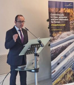
Plans for the pan-European Cadastral Data Strategy were presented at a recent workshop on Sustainable Business Models for NMCAs jointly organised by EuroSDR and EuroGeographics, which represents official national providers of geospatial information in Europe.
The OME2 project is co-funded by the European Union. It is being delivered by a consortium comprising: EuroGeographics, the not-for-profit membership association for Europe’s National Mapping, Cadastral and Land Registration Authorities; National Geographic Institute, Belgium; National Institute of Geographic and Forest Information, France; Hellenic Cadastre; General Directorate for the Cadastre, Spain; and Cadastre, Land Registry and Agency, The Netherlands.
It runs until the end of 2025.
EuroGeographics is an international not-for-profit organisation (AISBL/ IVZW under Belgian Law. BCE registration: 833 607 112) and the membership association for the European National Mapping, Cadastral and Land Registry Authorities.
To find out more about EuroGeographics, please visit www.eurogeographics.org
![]() The OME2 project is co-funded by the European Union. Views and opinions expressed are however those of the author only and do not necessarily reflect those of the European Union or European Commission. Neither the European Union nor the European Commission can be held responsible for them.
The OME2 project is co-funded by the European Union. Views and opinions expressed are however those of the author only and do not necessarily reflect those of the European Union or European Commission. Neither the European Union nor the European Commission can be held responsible for them.
Open Maps For Europe was co-financed by the Connecting Europe Facility of the European Union and ended in 2022. It was coordinated by EuroGeographics, the voice of European National Mapping, Cadastral and Land Registration Authorities, in partnership with the National Geographic Institute (NGI) Belgium.