Using the power of touch to bring tactile maps to life
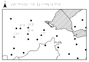
 The Netherlands Cadastre, Land Registry and Mapping Agency (Kadaster) is using Open Maps For Europe to develop a series of tactile maps for navigating by touch.
“Our aim is to make all geodata from Kadaster available and accessible to everyone. For blind and visually impaired people, the best way is to create tactile maps. Open Maps For Europe provided an easy way to access official topographic data from different countries and apply the production process we have developed for The Netherlands to other parts of Europe.”
Daan Rijnberk, Kadaster
