
Providing a web map service for investigating European Ground Motion
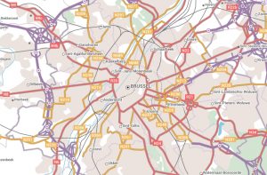 The European Environment Agency (EEA) is using multi-themed topographic open data from official sources as a selectable background map in its European Ground Motion Service (EGMS). Provided through the Open Maps For Europe interface, EuroRegionalMap provides an option for users of the EGMS data viewer who prefer to use maps rather than satellite images.
“The use of EuroRegionalMap open data in the European Ground Motion Service data viewer not only demonstrates the value of information available from National Mapping, Cadastral and Land Registration Authorities, but also highlights the benefits of our cooperation. We fully support the ambition to include map data from all Copernicus Participating States in future releases of Open Maps For Europe.”
Henrik Steen Andersen, Contract Manager, Copernicus In Situ Data