
Our products are priced according to coverage, number of users and other rights. See our pricing and licensing page.
| Product name | EuroRegionalMap (ERM) |
|---|---|
| Current version | 2021 |
| Release date | April 2021 |
| Nominal scale | 1:250 000 |
| Coordinate system | Decimal degrees ETRS89-WGS84 |
| Database structure | The EuroRegionalMap geodatabase model (GDB) has gathered all the feature classes into a unique dataset. The feature classes are defined as GDB simple feature class: area, line, point. The feature classes hold and define the attribute fields. The features are defined as a subtype of the feature class. Coded value domains have also been defined for attributes at the subtype level. |
| Database specification | ERM specification (serves as the User guide) |
| Delivery formats available |
ESRI File Geodatabase ArcGIS 10.1 ESRI Shapefile (on demand) |
| Data content |
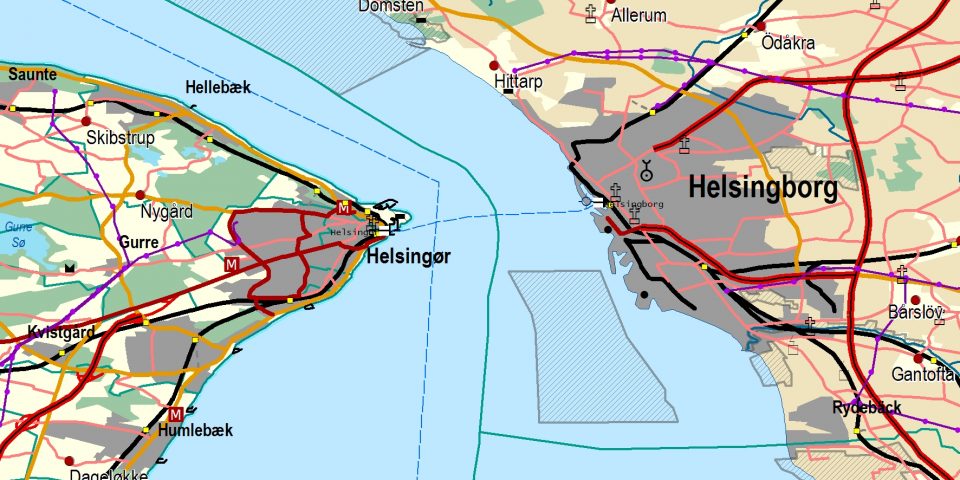
EuroRegionalMap contains 7 themes: The administrative boundaries (BND) theme holds information on the administrative entities down to the lowest level and their administrative hierarchy. A unified coding system for all the administrative levels is included. The water network (HYDRO) holds information on the watercourses like the name, the navigability and the width range and information on the open water area, the seaside and the associated hydrologic equipment (dams, locks). All watercourses form a continuous network with connectivity through open water and underground rivers. The transport network (TRANS) holds information on the roads and the railways, the ferry lines, the airports, and the harbours. Roads and railways are identified by their number or their code and form a connected network associated with features like railway stations, parking places, level crossings and road interchanges. Connections between the different types of transport have been added. The settlement theme (POP) holds information on the built-up areas and populated places including their name and the number of inhabitants. The vegetation and soils theme (VEG) holds features like wood, orchard or sandy area. The named locations (NAME) are just main text features of big geographic areas that are not portrayed in vector data and fit for cartographic purpose only. The miscellaneous theme (MISC) holds various topographic elements like power lines, landmarks, and buildings. |
| Change history |
The following themes were updated by NMCAs in 2020: BND, TRANS and POP. |
| Quality and standards |
Discovery Metadata for the ERM 2021 are provided in XML format, and are INSPIRE compliant and also according to the ISO 19115/19139 profile. Metadata exist for full coverage of Europe and at country level. The lineage files describe the production process, data quality and completeness of the data. The information is provided in PDF format. Lineage files exist for full coverage of Europe and at country level. |


Dataset includes:
Austria
Belgium
Bulgaria
Croatia
Cyprus
Czech Republic
Denmark including the Faroe Islands
Estonia
Finland
France including French overseas departments and Monaco
Georgia
Germany
Greece
Hungary
Iceland
Ireland
Italy including San Marino and Vatican City
Kosovo*
Latvia
Lithuania
Luxembourg
Malta
Moldova
Netherlands
North Macedonia
Norway
Poland
Portugal
Romania
Serbia
Slovakia
Slovenia
Spain including Andorra and Gibraltar
Sweden
Switzerland including Liechtenstein
Ukraine
United Kingdom (Great Britain and Northern Ireland)
*This designation is without prejudice to positions on status, and is in line with UNSC 1244 and the ICJ Opinion on the Kosovo Declaration of Independence
Several Data Samples are available to download for evaluation purposes.
The sample data is for internal evaluation purposes only. All are © EuroGeographics.
| Download Geodatabase sample files | 34 MB, zip |
|
Download Shapefile sample files
|
57 MB, zip
|

For more information about EuroRegionalMap or any of our products, please contact us.
To license any of our products, please visit our Licensing page.