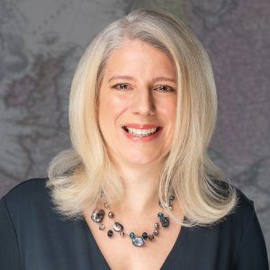
Sallie Payne Snell has been appointed Secretary General and Executive Director of EuroGeographics
EuroGeographics has today (12 October 2023) announced Sallie Payne Snell as its new Secretary General and Executive Director.
Sallie, who previously led operations at the not-for-profit membership association, has an in-depth understanding of the technological, legislative and operational challenges and opportunities facing National Mapping, Cadastral and Land Information Authorities.
Commenting on her appointment, she said: “It is a privilege to represent official providers of the trusted geospatial information that is fundamental to the everyday lives of people across Europe.”
“My focus is on enabling access to members’ high-value data and expertise for the public good through its integration into the infrastructures we rely upon as a modern society.”
“EuroGeographics and its members are already delivering high-value pan-European data through the Open Maps for Europe interface. We look forward to building on this success through the OME2 project, which is co-funded by the European Union and responds to user needs for large-scale open data.”
President of EuroGeographics, Colin Bray added: “We are delighted that Sallie will lead EuroGeographics as we take our next steps in realising its vision of a society empowered by the use of trusted geospatial services from official national sources.”
“Sallie is a great champion of members’ data and expertise, and her extensive experience in relationship management will be key to further establishing partnerships with those who share our goal of using geospatial data for the public good. These collaborations are vital for meeting user requirements and finding solutions to common challenges.”
Sallie’s previous positions include Deputy Director, Association for Geographic Information, and International Stakeholder Relationship Manager, Ordnance Survey. She holds a BSc in geographical science.
EuroGeographics is an international not-for-profit organisation (AISBL/ IVZW under Belgian Law. BCE registration: 833 607 112) and the membership association for the European National Mapping, Cadastral and Land Registry Authorities.
The OME2 project is co-funded by the European Union. It is being delivered by a consortium comprising: EuroGeographics, the not-for-profit membership association for Europe’s National Mapping, Cadastral and Land Registration Authorities; National Geographic Institute, Belgium; National Institute of Geographic and Forest Information, France; Hellenic Cadastre; General Directorate for the Cadastre, Spain; and Cadastre, Land Registry and Mapping Agency, The Netherlands.
Views and opinions expressed are however those of the author only and do not necessarily reflect those of the European Union or European Commission. Neither the European Union nor the European Commission can be held responsible for them.
Open Maps For Europe was co-financed by the Connecting Europe Facility of the European Union and ended in 2022. It was coordinated by EuroGeographics, the voice of European National Mapping, Cadastral and Land Registration Authorities, in partnership with the National Geographic Institute (NGI) Belgium.
