Pan-European geospatial datasets from official national sources updated to meet user requirements
EuroGeographics has released updates for two pan-European datasets created using official data from its members, Europe’s National Mapping, Cadastral and Land Registration Authorities.
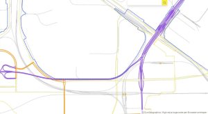
The seamless administrative boundary and topographic datasets are created by the not-for-profit organisation using a unique data integration process which harmonises national data to standard specifications.
Users wanting to geo-reference statistical information will benefit from the latest version of EuroBoundaryMap (EBM 2024) which supports interoperability with applications based on European Union LAU and NUTS codes. It also includes the new NUTS regulation that came into effect on 1 January, as well as major updates from France, Germany, Great Britain, Greece, Spain, Slovenia, Switzerland and Lithuania. Licensing information for EBM 2024, which is widely used within the European Institutions through EuroGeographics agreement with Eurostat, can be found at https://eurogeographics.org/maps-for-europe/licensing/.
“EBM 2024 provides a complete update of our pan-European geo-database for administrative and statistical units to meet user requirements and is accessible as a full coverage dataset or national datasets,” said Victoria Persson, Project Manager – Data Access and Integration, EuroGeographics.
“It enables the exact matching of administrative areas in 56 European countries and territories using geospatial data from 39 EuroGeographics members. Available at 1:100 000 scale, it contains geometry, names and codes of administrative and statistical units."
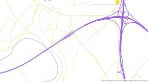
Working with Germany’s Federal Agency for Cartography and Geodesy (BKG), which manages the production of both datasets, EuroGeographics has also updated its 1:250 000 scale dataset, EuroRegionalMap (ERM), which covers 51 European countries and territories, to ensure it continues to meet user needs.
Tim Trautmann, Product Manager for EBM and ERM from BKG explained: “ERM has a long history, starting in the early 2000s, and today contains around 7 million objects in 60 layers. It is now available under an open licence via Open Maps For Europe, and we’re seeing users discovering and embracing new ways to benefit from the data.”
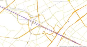
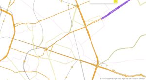
“Our survey showed that its main use is as a reference dataset for base mapping with users stressing the need for complete and up-to-date information. To meet these requirements, ERM 2024 improves the settlement, administrative boundary and hydrographic themes, and we have enabled EuroGeographics members to provide data outside the thematic update cycle, which improves the timeliness.”
“This update also addresses several user feedback issues related to positional accuracy and edge matching. An additional validation algorithm for edge-matching has been implemented to improve the boundary harmonisation, and we have re-evaluated quality requirements to focus on those that are most important for the main use cases. This work is continuing.”
The Open Maps For Europe 2 (OME2) project is enhancing the five existing Open Maps For Europe datasets available via www.mapsforeurope.org. It is co-funded by the European Union and is being delivered by a consortium comprising: EuroGeographics; National Geographic Institute, Belgium; National Institute of Geographic and Forest Information, France; Hellenic Cadastre; General Directorate for the Cadastre, Spain; and Cadastre, Land Registry and Agency, The Netherlands.
EuroGeographics is an international not-for-profit organisation (AISBL/ IVZW under Belgian Law. BCE registration: 833 607 112) and the membership association for the European National Mapping, Cadastral and Land Registry Authorities.
The OME2 project is co-funded by the European Union. It is being delivered by a consortium comprising: EuroGeographics, the not-for-profit membership association for Europe’s National Mapping, Cadastral and Land Registration Authorities; National Geographic Institute, Belgium; National Institute of Geographic and Forest Information, France; Hellenic Cadastre; General Directorate for the Cadastre, Spain; and Cadastre, Land Registry and Agency, The Netherlands. ![]()
Views and opinions expressed are however those of the author only and do not necessarily reflect those of the European Union or European Commission. Neither the European Union nor the European Commission can be held responsible for them.
Open Maps For Europe was co-financed by the Connecting Europe Facility of the European Union and ended in 2022. It was coordinated by EuroGeographics, the voice of European National Mapping, Cadastral and Land Registration Authorities, in partnership with the National Geographic Institute (NGI) Belgium.
 Organised by the Latvian subsidiary of
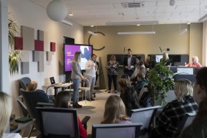
  rzina explained: “The shadows were mostly concentrated in our Riga Coworking spaces, some of them being in our Jelgava office as well. We organised the first part of the event as getting to know each other by playing the ‘association game’ together. The Director General and the Cadastre Development manager gave the students a general introduction to the areas of activity of the State Land Service. An interesting story with practical demonstrations of various archive documents was given by the Head of our Archives. Students had a chance to learn how to use various tools to carry out building measurements also. In addition, we played a short quiz and took a walk together to get to know the co-working office premises, so that afterwards the students could get to know their chosen professions more closely.”