
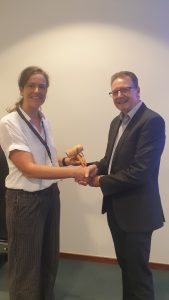
Jonathan Holmes, Data Management Lead, Ordnance Survey, congratulates Karin Mertens, Quality Control Manager, National Geographic Institute on becoming new Chair of EuroGeographics Quality Knowledge Exchange Network (QKEN).
EuroGeographics has named data quality expert, Karin Mertens from National Geographic Institute (NGI), Belgium as Chair of its Quality Knowledge Exchange Network (QKEN).
Karin is Quality Control Manager at NGI. She succeeds Jonathan Holmes, Data Management Lead, Ordnance Survey, who has held the role since 2015.
The expert group is part of the extensive knowledge exchange programme organised by the not-for-profit membership association for the European National Mapping, Cadastral and Land Registry Authorities.
Carol Agius, Head of Representation and Stakeholder Engagement, EuroGeographics said: “Karin has extensive experience and expertise in ensuring the usability of geospatial data. We are delighted to welcome her as Chair of our quality expert group and would like to thank Jonathan for his committed leadership in its development over the last eight years.”
“As the national authorities for official geospatial information in Europe, high quality and reliability is the calling card of EuroGeographics members.The QKEN enables them to share expertise and best practice to ensure that their data continues to be trusted and the implementation of new technology does not impact on quality.”
“Our discussions also focus on ways to bring together data from multiple sources to ensure seamless, high-quality datasets and communicate the quality, relevance and content to users, in particular through the Open Maps For Europe 2 (OME2) Project. OME2 will develop a new production process and technical specification for free-to-use, edge-matched data under a single open licence.”
EuroGeographics is an international not-for-profit organisation (AISBL/ IVZW under Belgian Law. BCE registration: 833 607 112) and the membership association for the European National Mapping, Cadastral and Land Registry Authorities.
The OME2 project is co-funded by the European Union. It is being delivered by a consortium comprising: EuroGeographics, the not-for-profit membership association for Europe’s National Mapping, Cadastral and Land Registration Authorities; National Geographic Institute, Belgium; National Institute of Geographic and Forest Information, France; Hellenic Cadastre; General Directorate for the Cadastre, Spain; and Cadastre, Land Registry and Agency, The Netherlands.
Views and opinions expressed are however those of the author only and do not necessarily reflect those of the European Union or European Commission. Neither the European Union nor the European Commission can be held responsible for them.
Open Maps For Europe was co-financed by the Connecting Europe Facility of the European Union and ended in 2022. It was coordinated by EuroGeographics, the voice of European National Mapping, Cadastral and Land Registration Authorities, in partnership with the National Geographic Institute (NGI) Belgium.