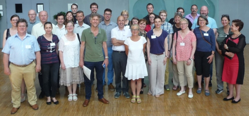
Although INSPIRE is not a directive that requires new data capture, using INSPIRE data specifications as a basis for national or community extensions is strongly encouraged. In practice, this may be done through “formal extensions” respecting the rules of the INSPIRE Generic Conceptual Model or through more flexible adaptations. The EuroGeographics by INSPIRE Knowledge Exchange Network, EuroSDR and Geonovum organised the workshop at 20-21 June 2017 in order to share experiences on this topic.
Download the minutes…
Presentations
| Presentation |
Presenter |
Video |
| Introduction session, 20th June 2017 |
| Welcome and introduction |
Morten Borrenbaek (Kartverket, Norway) |
video record |
| Why INSPIRE needs extensions – the European perspective |
Michael Lutz (Joint Research Centre) |
video record |
| Influence of INSPIRE on European/national data specifications |
Saulius Urbanas (EuroGeographics) |
video record |
| Learnings and questions about data interoperability in the biodiversity community |
Dominique Laurent (IGN France) |
video record |
| Pilot project on EU Disaster damage and loss database |
Giacomo Martirano (Joint Research Centre) |
video record |
| Danish models inspired by INSPIRE |
Heidi Vanparys (SDFE Denmark) |
video record |
| National Examples session |
| Extending the INSPIRE theme Utility Networks Data Model, from a business point of view |
Ad van Houtum (Kadaster Netherlands) |
video record |
| Norwegian standards based on the INSPIRE Network models |
Knut Jetlund (Norwegian Road Administration) |
video record |
| Data exchange in local level in Sweden |
Gunhild Lönnberg and Åsa Sehlstedt (Landmateriet, Sweden) |
video record |
| Extending INSPIRE Cadastral Parcels model to cover the whole Cadastral Map according to the Czech law |
Michal Med (CUZK, Czech R.) |
video record |
| National and Federated Examples session |
| How INSPIRE has influenced the redesign of the French hydrographic network |
Stéphane Garcia (IGN France) |
|
| New Environment and planning Act: Information standards will partly re-use INSPIRE but not extend |
Paul Janssen (Geonovum) |
video record |
| How INSPIRE has influenced the redesign of French topographic database |
Dominique Laurent (IGN France) |
video record |
| Data model extension on NGI standard products: yes, no? |
Nathalie Delattre (IGN Belgium) |
video record |
| ELF modelling guidelines |
Heidi Vanparys (SDFE, Denmark) |
video record |
| European Examples session |
| INSPIRE compliant e-reporting under the Air Quality directives from a member state perspective (Belgium) |
Olav Peeters |
|
| Pilot project on energy extending INSPIRE buildings 2D |
Giacomo Martirano (Joint Research Centre) |
|
| Federated and European Examples session, 21st June 2017 |
| INSPIRE federating national stakeholders for a national model on Buildings in Spain |
Amalia Velasco (SDGC, Spain) |
|
| Planned land use from Norway |
Morten Borrenbaek (Kartverket, Norway) |
|
| GeoSmartCities |
Stefania Morrone |
|
| UN GGIM Core data and adaptation of INSPIRE models |
Dominique Laurent (IGN France) |
|
| CAP and INSPIRE: history, perspectives and challenges |
Katalin Toth (Joint Research Centre) |
|
| Future – Research session |
| CDDA 2018 – linked approach and the EU Registry – INSPIRE PF extension |
Stefania Morrone |
|
| Creation and Evaluation of an INSPIRE HY Extension – a Swedish case study |
Helen Eriksson (Landmateriet, Sweden) |
|
| INSPIRE and Linked data: a EuroSDR road map |
Benedicte Bucher (EuroSDR) |
|
| Main learnings of Geonovum survey (as Masterclass) |
Thorsten Reitz (Geonovum) |
|


